
See a map of Prince Edward Island HERE!
See a map of where Prince Edward Island is HERE!
| PEI TRIP LOG |
|||||
| This is the final log of Infrared's trip to PEI in 2004. Note that the events have been put in chronological order. The original log may still be found HERE. | |||||
| REPORTING DATE | LOCATION | COMMENTS | PICTURES (Click on image for larger version) |
||
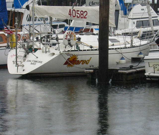
| June 2, 2004 | Chesapeake City, MD | We (John Schneider of Accomack County, VA and I) got underway from Baltimore at 0920 after dealing with a dead battery problem which required attaching the AC power cord to pump enough charge to get the engine started. Light morning winds meant we were to motor anyway so expected to have plenty of time to recharge. However after a couple of hours, the ammeter was showing a slight discharge from both battery banks when it should show them charging! This was cause for some concern, if the batteries were not charging, we would not be able to restart the engine. So although we sailed for a little more than three hours midday to mid-afternoon, we left the engine running. After reaching the Canal House wharf in Chesapeake City, where access to AC power meant we could recharge if necessary, we shut the engine down. Much to our relief, the engine restarted and the battery banks were fully charged. It appears that that ammeter is not operating and is stuck. The weather was quite variable throughout. Morning calm, midday winds, convection and showers in the afternoon, and a very blustery drenching squall in the evening - by which time we were in the bar at the Canal House. |
|||
| June 3, 2004 | Cape May, NJ | Departed Chesapeake City at 0620 to catch the eastbound current in the C & D Canal. Good run down the Delaware Bay although with a wind on the stern, it was a motor sail. The Delaware Bay isn't all that interesting anyway, so it was a matter of getting past these waters with minimum of pain and we accomplished that! Arrived at Cape May just after low tide so no problem getting under the bridges, but with a full moon, the low tide was expected to be lower than usual and, in the rather shallow Cape May harbor, Infrared's 6.5 foot keel was cause for concern. With due caution we inched our way into Utsch's Marina (the only Cape May marina I know of with enough water for us) and tied up. So far no trouble! We plan to go to Atlantic City tomorrow (~35 nm) and anchor over - there is no reason to go ashore in that dump. Saturday is looking like a foul weather day and we had planned to run from Atlantic City to Sandy Hook (~85 nm) but the weather forecast is discouraging, so we may be trapped in Atlantic City...ouch! |
 Utsch's Marina in Cape May. |
||
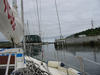
| June 5, 2004 | Atlantic City, NJ | We left Cape May shortly after 1100 hours yesterday, expecting the winds to veer from N to E and eventually providing a reach over 35 nm into Atlantic City. That forecast didn't work out as the system slowed and strengthened, developing winds 15-22 kt from the north. That speed isn't too bad, but the direction was terrible - right on the nose. We sailed with a double reef for four and a half hours beating into the wind and finally turned on the engine for a slog into 3-6 ft waves into Atlantic City. The whole trip took over nine hours so our average speed over ground (SOG) was a paltry 4 kt. We arrived at anchor before the rain moved in which it certainly did overnight. Today, the storm is trying to pass by so we are staying at anchor just below the Brigantine bridge in Absecon Inlet. What a bad place to be held up! The one tolerable marina in Atlantic City demands $4.00/foot which, on principle, ought not to be paid so we are on the boat through tomorrow. |
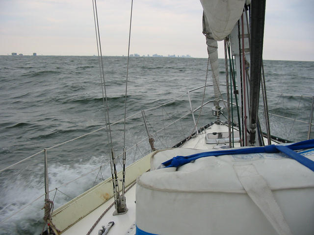 Slogging northbound into Atlantic City. |
||
| June 6, 2004 | Atlantic City, NJ | I looked out the companionway at 0530 and saw rain and a 20-25 kt north wind. Facing the prospect of an 85 nm slog through heavy seas, I yielded to the Atlantic City pirates and moved Infrared over to the Farley State Marina and paid the exorbitant rate. We will leave early tomorrow for Sandy Hook. |
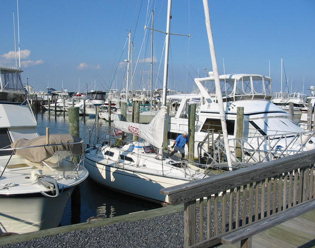
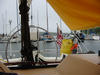
 Infrared at the Trump Marina in Atlantic City. |
||
| June 9, 2004 | Newport, RI | We finally were paroled from the Atlantic City gulag and split for points north and east on Monday, June 7. With a forecast for north winds 5-10 kt shifting to SE in the same speed range we were optimistic that we might have some actual sailing on the passage to Sandy Hook. No such luck. North wind on the nose went directly to S on the stern with no reaching possible. Well, no matter, that trip up the New Jersey coast is a chore to be completed with (generally) no fun expected. We left at 0620 and threw down the anchor by the Coast Guard station on Sandy Hook twelve hours later. The distance is 85 nm meant a surprisingly swift average motoring speed of 7 kt. Tuesday morning we left anchor at 0800 to catch the current up the East River through Hell Gate and into the Long Island Sound. We were under the Throgs Neck Bridge around noon having clocked SOG's above 10.5 kt past the United Nations building. Upon getting out into the Long Island Sound, we found the winds to be very light and the water very flat. It was easy motoring so we decided to take the opportunity to make up some of the time lost to weather in Atlantic City by staying on the water and not stopping for the night. About 1530, the wind picked up and miraculously was on a starboard beam reach! We shut the engine off and proceeded to sail at 7-7.5 kt over the water and, with a lift from the current, above 8 kt SOG. It was dream sailing. The water was flat as can be with the wind blowing 12-18 kt, a phenomenon I can't explain, but certainly welcomed. Nothing good lasts forever and really good things not long at all, as the saying goes, and the wind suddenly went calm at 2100. So we motored the rest of the night eastbound on the Sound, through the turbulent waters of The Race in blackness. It was there that we encountered the commercial traffic lane and crossed with only a half hour or so of ("is that freighter coming at us?!!") excitement. We arrived in Newport at 0800 twenty four hours after leaving Sandy Hook. After fueling up at the Yachting Center we opted for a slip at the Newport Yacht Club (where this is being composed). The first order was a shower the second for some nap time. Tomorrow is a planned layover and it looks like it will be a nasty weather day anyway. Friday (June 12) we expect to depart for Marblehead by way of Buzzards Bay and Provincetown. |
 Verrazano Narrows into NYC. 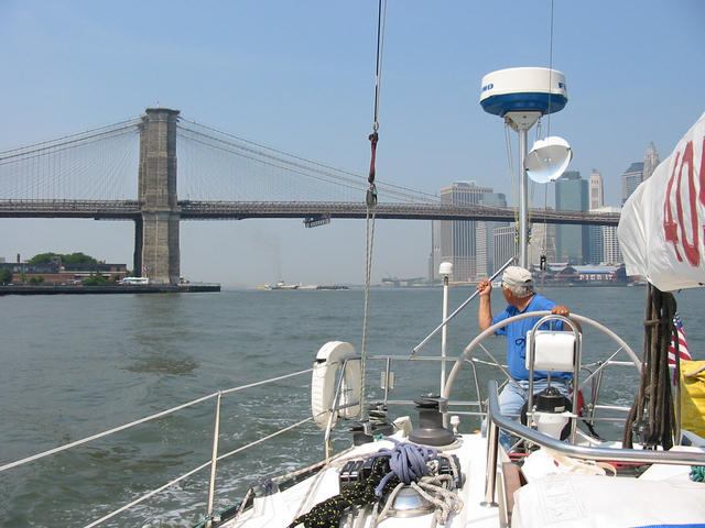 Brooklyn Bridge.  Statue of Liberty beyond Governors Island |
||
| June 10, 2004 | Newport, RI | This is a planned layover since I like Newport. Among other things, one can see so many spectacular yachts along the waterfront. I had a tinge of regret that we didn't tie up at the Newport Yachting Center as it seems that there is a Swan Nautor rendezvous at the center. Baltic Yachts was founded by guys from Swan and is now not far from the Swan yard, so it could have been amusing to have Infrared, a renegade Finnish yacht, in the middle of their gathering!
A major disappointment here in Newport is that my heretofore favorite spot, the Red Parrot, has discontinued my favorite dish. Their Peri-Peri (a bouillabaisse relative) is no longer on the menu! That hurts. I did some re-provisioning at the market up the hill on Belvedere (the main street through the mansion district) and generally wandered about trying to find a solution to the USB port-to-flash-card-connection problem. Tourist towns are great for food, drink, and kitch but don't expect to find technical solutions. The plan is to make a run for Provincetown tomorrow. It's about 75 nm and we hit the Cape Cod Canal at time of favorable eastbound current so, unless the winds turn out to be hopelessly obstructive, we ought to make it in daylight. It does mean, however, another first light departure. |
|||
| June 11, 2004 | Plymouth, MA | It was indeed an early departure. We left the dock in Newport at 0620 after arising at 0500, but the early start seemed to pay off as we left Narragansett Bay. When we turned eastward after Benton Shoals, we had excellent wind on a close reach and churned up the waters of Rhode Island Sound into Buzzards Bay at (over water) speeds consistently above 7.5 kt. Unfortunately, it was a port tack and when we needed to turn left into Buzzards Bay, it became a wind on the nose. Thus, we motored up to and through the Cape Cod Canal with dying wind. As we emerged from the canal, we put up the sails again, but found the light wind coming directly from the heading to Provincetown. That caused a left turn up the Cape Cod western coast and I chose Plymouth as our stopover. I arranged a berth at the Brewers Marina and we arrived at 1800. A trip to the marina bar yielded a wealth of information about the town and the various eating/drinking establishments therein. So we set about touring. After seeing Plymouth Rock, we looked at Main Street (very quaint) by ended up back at the marina for dinner. We expect to have an easy run into Marblehead tomorrow. |
|||
| June 12, 2004 | Marblehead, MA | Plymouth turned out to be an okay choice. The town (from what little we could see walking from the marina) seemed very attractive and we actually were docked very close to Plymouth Rock! Now the question that arises from looking at the charts: if the undredged depth of that harbor area is 1-5 feet and the 3 mile channel has similar depths outside, how did those wacky Pilgrims get that massive wooden ship in there?
The bar and restaurant at the marina got the nod after we surveyed the other possibilities nearby and it turned out to be a good decision. Chatted it up with some locals and ate well in the very presentable upstairs bar. We headed out at about 0920 after fueling up (yesterday we used less that five gallons of diesel to motor ten hours!) and exited the Plymouth harbor in 15 kt of wind (did you guess it?) on the nose. Fortunately the wind simply died as the morning went on, so the motor slog became progressively less annoying. Otherwise it was a spectacular day, with cool sunshine and infinite visibility. As we arrived in Marblehead harbor, there were quite a few sailboats out in the waters between Marblehead and Gloucester and, at least, two regattas in progress. It is still early in the season up here and we saw that there were still many unoccupied moorings in Marblehead harbor, and, indeed, we found that the Boston Yacht Club was able to provide us a mooring. (It may sound odd but the Boston Yacht Club is in Marblehead.) We then adjourned to the yacht club bar for a gin and tonic and took in the view form the balcony (photo). Crewman John Schneider (photo) will depart back to Virginia tomorrow and I will be here until next weekend before leaving for Portland. |
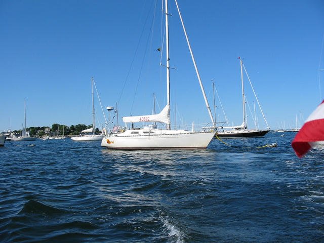 On a mooring in Marblehead harbor. |
||
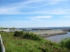
| June 15, 2004 | Marblehead, MA | It's a couple of days into the planned layover in Marblehead. I am staying in my sister Beth and brother-in-law Bob Shear's garage apartment which is about 200 meters from the rocky neighborhood ocean beach. It's very pleasant. My parents are also living here so I am contributing somewhat to the various chores that need doing. Sandy is flying up for the weekend, arriving Thursday and returning to Catonsville late Sunday. I expect to be headed out for Portland via Isle of Shoals on Monday but that's ±1 day for weather considerations. |
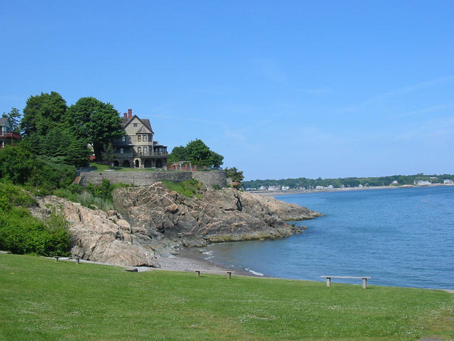 View from Greystone Beach. |
||
| June 18, 2004 | Marblehead, MA | Sandy arrived by AirTran yesterday but it seems that the cloudy and drizzly weather arrived simultaneously. Nephew Ted and I repaired one of the other bicycles so there are now two in working conditions. By bike is the best way to get around Marblehead with its narrow streets and difficult parking and, finally, late this afternoon the drizzle diminished (but didn't disappear) enough for us to take a ride around town. I needed to stop by the Boston Yacht Club to tell the dockmaster that I am leaving on Monday not Sunday so we had a good excuse to pedal along the waterfront and eventually out to Fort Sewell at the harbor entrance. |
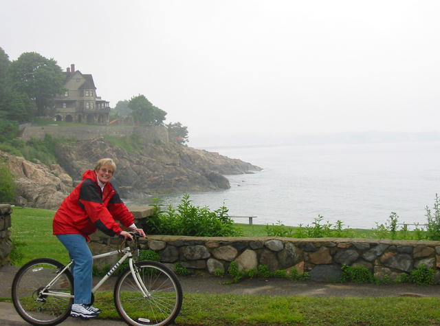 A drizzly Greystone Beach by bike. 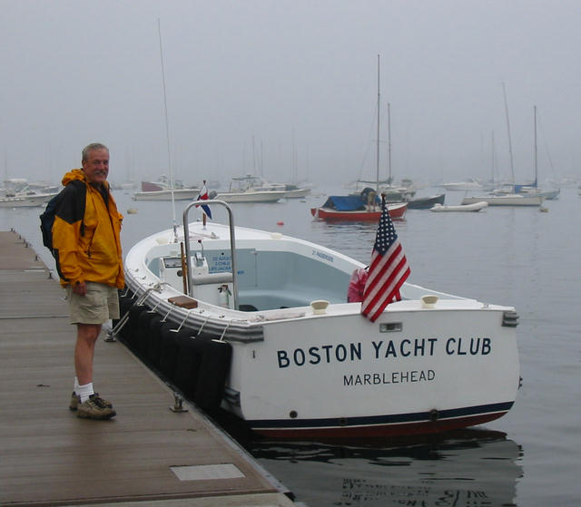 Looking for the dockmaster. |
||
| June 22, 2004 | Kittery, ME / Portsmouth, NH | With Sandy off to Baltimore on Sunday afternoon, I left Marblehead Monday morning heading eventually for Portland, ME. Initially I had intended to layover at Gosport Harbor in the Isle of Shoals, but a few things changed my mind. First, there was the excellent sailing! With a westerly wind the leg from Marblehead eastbound for Cape Ann was a not unpleasant downwind motor sail. However, when turning north toward Maine, the wind picked up just enough and on a beam to close reach from W-NW to make for ideal sailing conditions. With offshore wind the seas were flat as the Patapsco River and Infrared was happily plowing along at 6.5-7.2 kt. I was moving so well that I would have been into Isle of Shoals just before 1600 and since I was to stay on the boat for the night, it would have been a while until dinner time. The other considerations were weather related. Today (Tuesday) was forecast to be rainy with thunderstorms and winds gusting above 30 kt in the afternoon, not pleasant sailing weather. Additionally, the W-NW wind I experienced was to have persisted overnight at 15-25 kt and Gosport Harbor is open to the west, so it would have been a rocking time on the mooring. Not having visited the Portsmouth area before, it seemed like a good idea. During the last two hours into harbor, the wind picked up, gusting to 25 kt, so I ended up with a double reef in the main and the headsail furler reefed and still flew along at 7 kt. I wrestled the mainsail down in the outer harbor and started motoring around looking for dockage that was close to town. Since it looked like I would wait out the nasty weather expected today ashore, I wanted to be able to see the sights. It couldn't have worked out better! I spotted the Kittery Landing Marina just before the first of two draw bridges and although usually full, they had a couple of late arriving seasonal customers so here I am. The place has a very accommodating dockmaster and excellent facilities at a very reasonable price. Today I plan to wander over the bridge into Portsmouth (which is right on the state line with Maine so this side of the river is Kittery, ME and the other is Portsmouth, NH). Tomorrow, the clouds are to part and the wind go back to W at 10-15 kt, which should be ideal for the 40 nm jaunt up to Portland. |
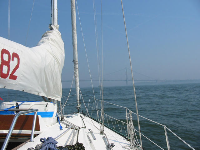
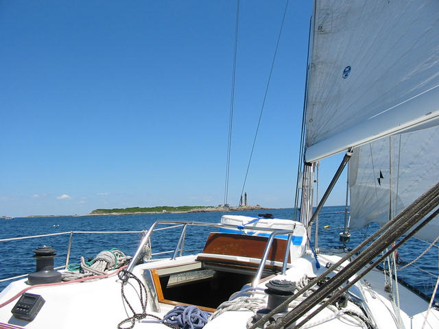 The twin lighthouses on Cape Ann. 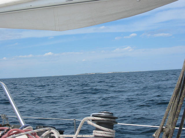 Bypassing the Isle of Shoals heading into Portsmouth harbor. 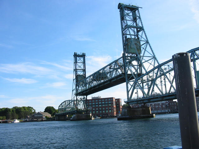 Drawbridge seen from Infrared at Kittery Landing Marina. 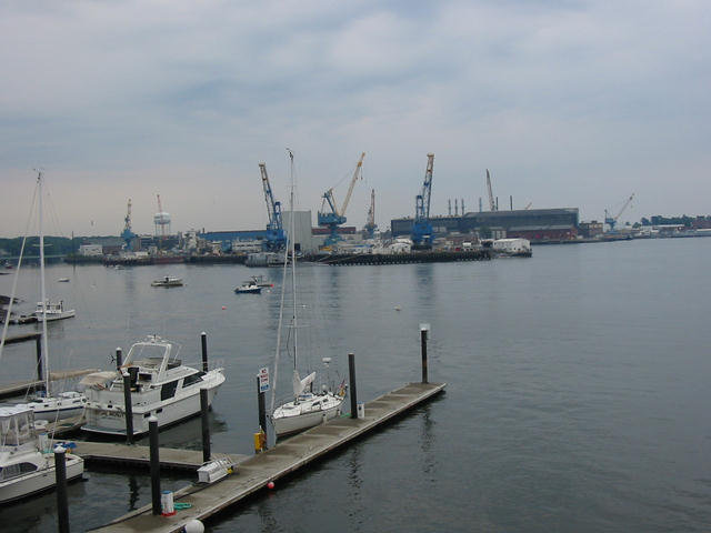 Infrared from the drawbridge. Portsmouth Navy Shipyard in background. |
||
| June 23, 2004 | Portland, ME | Loosed the dock lines in Portsmouth at 0700 for the 40 nm trip to Portland, ME. One of the interesting things about Portsmouth is the huge current that runs with the cycle of tides, reaching speeds 2-3 kt. I saw more turbulence on the trip out of Portsmouth than we saw in Hell Gate in New York! Needless to say, I timed departure to coincide with a favorable run down the river. Once in the ocean, the wind from the west was excellent for some fast sailing; in fact, fast enough to have Infrared end up with a double reef in both sails and moving at over 7 kt! By 0830 the winds were up to 20-25 kt on a nice reach. It looked real good! But not good enough to last. This was a day of very mixed sailing conditions. From a double reef at 7 kt, an hour later the reef was gone but still sailing well. Then, very suddenly two hours later, the wind went to zero (now this is a phenomenon I am familiar with on the race course, but not expected in the vast wind field over the ocean!) so motor on. The wind puffed at no more than 2 kt for a while and then came back to 8-15 kt on the same reach so back to sailing again. This pattern repeated two more times before the wind finally went to SW at 8 kt so it was motoring into Portland. The headline event of the day was the appearance of some whales (photo) just off of Saco Bay. These were not large whales but much like the whales we had seen in Newfoundland that were described to us as Pilot Whales. |
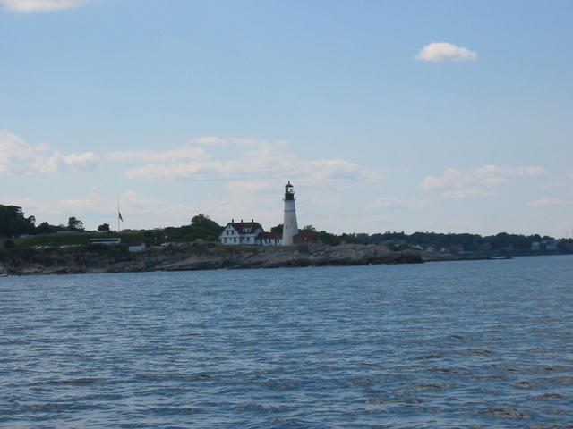 The lighthouse at the entrance to Portland Harbor.  Commercial traffic into Portland. |
||
| June 23, 2004 | Portland, ME | Several people (including Sandy several times) have asked me why I'd rather sail up here than in those warm luxurious tropical waters. Well, the answer may be that it might be too easy down south or maybe I need a consultation with the Catonsville Yacht Club Staff Psychiatrist. Today at noon in the center of Portland (not on the waterfront) it was a brisk 57°F under overcast skies and with some moderate fog (probably dense fog just offshore). It would indeed be a chilly day to be on the water. The good news is that I am not on the water, but tied up at DiMillo's wharf in downtown Portland. Lately the rhythm of the weather has fallen in very nicely with the travel schedule and it looks like another batch of bad weather will just be moving eastward by Saturday when the overnight trip across the Gulf of Maine to Yarmouth, Nova Scotia is planned to begin. Erin Altemos from the racing crew is due to arrive by air tomorrow morning so it will be two of us headed for Canada. He expects to depart from Halifax in ten days so we are hoping that the weather stays at least moderately cooperative and we are able to get across to Yarmouth and then around Cape Sable without serious delay. I figure four sailing days with overnight stops to go from Yarmouth to Halifax, and with the two days across to Yarmouth, more than three days lost to weather would be undesirable. |
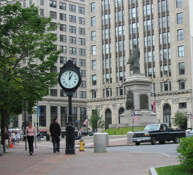 Downtown Portland, ME (at 1300 hours). 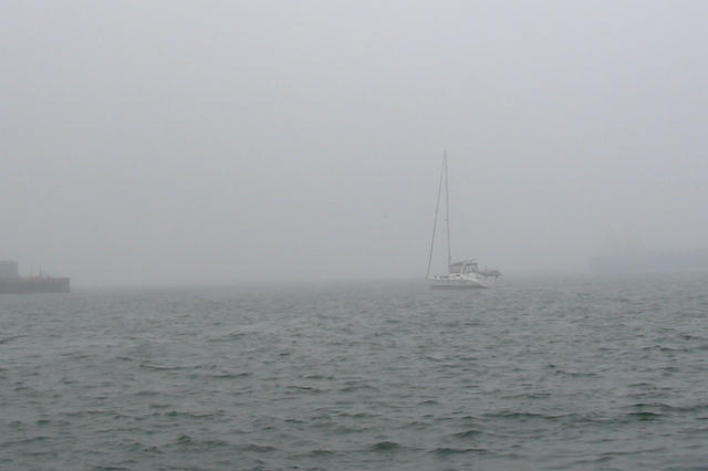 I hope that's not us on Saturday. 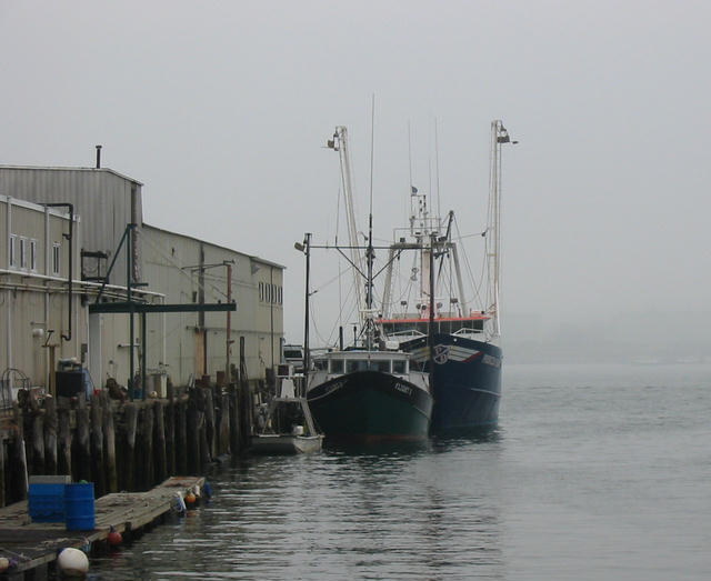 Even the fishermen are in port. 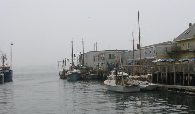 Another waterfront scene. |
||
| June 26, 2004 | Portland, ME |
The plan to exit Portland for Yarmouth today was washed out. Although yesterday was cloudy, it wasn't until last evening that the rain began and it has continued steadily through midday today. Also, the visibility is poor so we decided to wait until tomorrow (Sunday) when the stationary front is expected to work eastward and admit dryer west winds and sunshine. Erin did arrive on schedule yesterday and Infrared is prepared and ready. The current plan is to leave early tomorrow and arrive in Yarmouth around midday on Monday (it's a 180 nm, 30 hour transit). That will allow us to refuel that afternoon. Yarmouth has no dockside fuel so we will use the gerry cans and take a cab to a gas station - things are a bit more primitive in Nova Scotia. Hoping the west winds hold, we then will exit Yarmouth and round Cape Sable on Tuesday. The currents are agreeable for a morning to early afternoon passage to Brazil Rock. Here's hoping the weather cooperates over the next few days! |
 Rain has us pinned down in Portland. |
||
| June 28, 2004 | Yarmouth, NS |
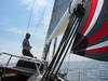
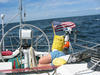
Waiting a day was an excellent idea. We left Portland yesterday morning at 0600 for the trip across the Gulf of Maine to Yarmouth, Nova Scotia; our entry point into Canada. As the photos show, the weather was bright and sunny and the wind picked up as expected after a couple of hours and we raised the sails. For the next twelve hours of so, it was the perfect sailing experience. A beam to broad reach with winds 10-15 kt and boat speeds 6.0-7.0 kt. We put up the asymmetrical spinnaker for a little less than two hours and took it down when the wind increased about 15 kt. We saw a large collection of porpoise who played along with us for 30 minutes or more, diving under the boat, riding the bow wave, and generally checking us out. Perhaps it was the bright spinnaker, but I have not seen porpoise in the open ocean come that close for that long to Infrared. It was very cool! Toward the end of the day, the wind picked up to a brisk 20-25 kt and stayed there overnight. The wind speed was not initially a problem since the the wind was on the aft quarter, but so then so also was the wave activity which continued to build. It made for a rocking night with the boat wallowing dramatically as the waves would push the stern aside and lift and shove. We had the reefed main firmly prevented and the Autohelm 6000 did a masterfully powerful job of handling the conditions without trouble. But the crew was not very comfortable. We were not bothered by traffic. The Scotia Prince (the huge ferry between Portland and Yarmouth) passed on schedule and was obvious in the unlimited visibility. We arrived into Yarmouth just ahead of the giant Cat - the high speed catamaran ferry from Bar Harbor. We pulled up to the town dock at Killam's Wharf at 0100 having made the 180 nm passage in 28 hours for a respectable average boat speed of 6.4 kt. We were the only boat at the wharf so we had choices. Next was a call to Canadian Customs. I suppose that all this tightened security has now conjured up the idea of terrorists on sailing yachts because we were actually boarded and searched. (On the 2002 trip we cleared into Canada twice over the phone!) After an hour or so however, we were admitted to the country and checked into the marina. Nothing had changed from our previous visit, they have one of the best rate structure imaginable - first night is free and it's $0.50 a foot for thereafter (and that's Canadian money!). Although the docks themselves are a bit underbuilt, the facilities are first rate and the dockmistress is most helpful. After a few chores which included fueling from the gerry cans, getting Canadian money and Nova Scotia beer (Schooner and Keiths), jury rigging a broken batten, and taking a shower. It was off to the nearby bar for drinks, food, and discussion of Canadian government since it was a national election day for the federal government. |
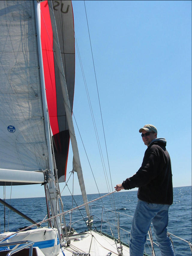 Erin flying the spinnaker in the Gulf of Maine headed for Yarmouth.  Porpoise checking us out. 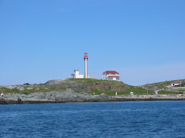 Light at Yarmouth harbor entrance. |
||
| June 29, 2004 | Lockeport, NS |
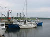
We were up and off the wharf at Yarmouth before 0600 to take maximum advantage of the favorable current around Cape Sable. This is a necessity since that current is generated by the huge Bay of Fundy tides. Speeds can reach 3-4 kt so one definitely doesn't want to be swimming upstream. Fortunately, the timing was most convenient for us, the current was to turn in our favor at 0800 and turn against us at 1330 and that's just enough time to get around Cape Sable and out of the waters significantly influenced by the current. On the down side, the forecast was for areas of fog and showers but we decided to go anyway. It is possible to get trapped in Yarmouth for days waiting for tolerable weather so we wanted to get out while in this window of opportunity. Just as we were approaching the Tusket Islands and Schooner Passage the fog cleared and we passed through the islands in sunshine. It is the most beautiful scenery on the passage and miraculously the weather cooperated! The rest of the way we motored in and out of the fog but amazingly the seas at the feared Cape Sable were flat as can be. We arrived at the marina in Lockeport and found one other sailboat along with two fishing boats. The marina is next to a large fish processing plant so there were some big fishing trawlers nearby. Chatting with a couple of the fishermen working on their boat in the marina, we heard that things are looking up for Lockeport. The fish plant is hiring on another shift and another fish processing facility is due to open soon. This is good news, we found things quite depressed two years ago. |
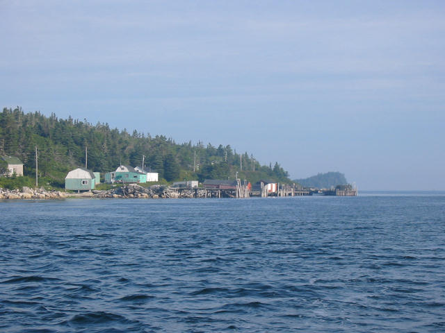 Wharf on John Island in Schooner Passage. 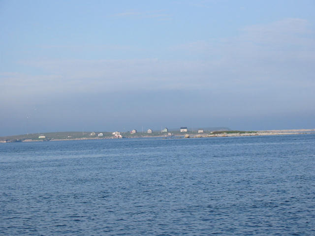 Village of Ellenwood in the Tusket Islands.  Motoring in the fog at Cape Sable.  The Lockeport Marina near the fish plant. |
||
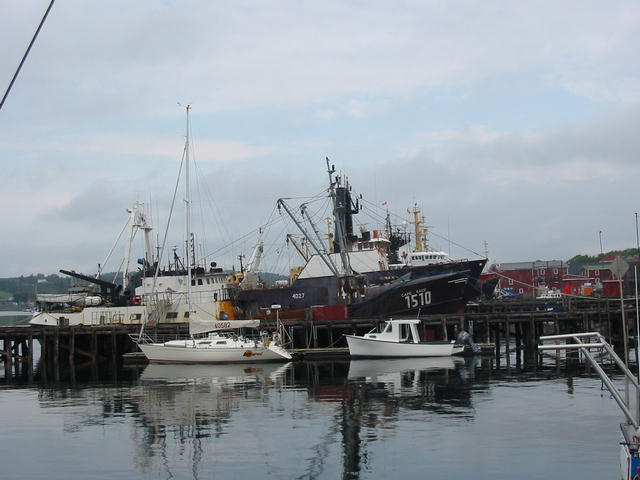
| June 30, 2004 | Liverpool/Brooklyn, NS | This was a generally uneventful day. We motored the entire way from Lockeport to Liverpool, a distance of some 35 nm, in fog with calm winds. Radar saw no other traffic and we pulled into the Brooklyn Marina at about 1600. Just to make it fun, the wind did indeed pick up to 18 kt just as we were moving to tie up, but with help from a uniformed RCMP officer, we fastened to the leeward side of the wharf. I think the Brooklyn Marina is one of the most welcoming places in Nova Scotia. It is really a club not a commercial business. They have floating docks, good facilities, a fantastically friendly membership, and there is no charge (they ask for a voluntary donation). Brooklyn is a couple of miles from Liverpool and is really a suburb if such a thing can exist in an area with 2800 inhabitants. We took a cab into Liverpool and got a brief tour from the cab driver and then a chance to walk about. Liverpool is quite an attractive town and hardly the dull place the cruising guides suggest. Tomorrow, July 1, is Canada Day and additionally, Liverpool has their Privateer Days weekend. The boys at the marina worked on us to stay for the late afternoon race and we gave it some thought. |
 Infrared at Brooklyn Marina. Bowater Paper in background. 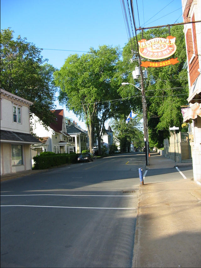 Street scene in Liverpool. 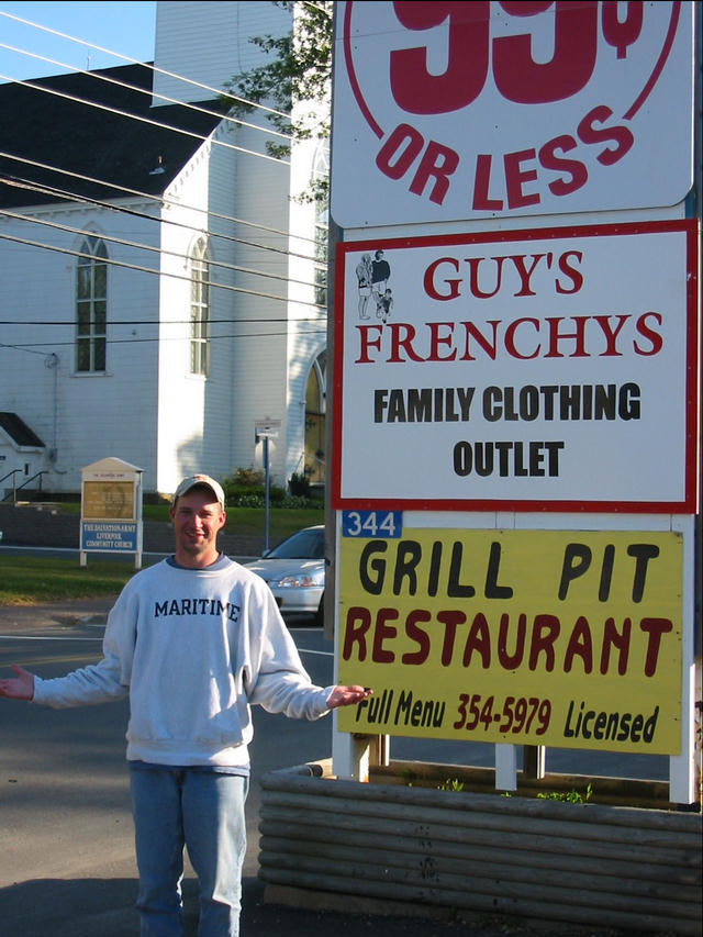 Church to the left, Grill Pit to right. Which shall it be? |
||
| July 1, 2004 | Lunenburg, NS | Our choice to leave Liverpool was a tough one since they were geared up for a weekend of festivities. However, we decided to move along although the weather didn't look all that great. It turned out to be a good decision. The clouds thinned out and the offshore fog never did thicken and to top it all, there was a nice wind for sailing. We flew the spinnaker for almost three hours. Arriving in Lunenburg, we found dockside accommodations at Scotia Trawler which, as the name suggests, is not a marina but a shipyard. Lunenburg is certainly a center for tourism but it is still actively engaged in ship repair and building. There is enough to see here that we plan to lay over a day. Today is Canada Day but there is no noticeable celebration here in Lunenburg. We are told that there are parades, fireworks and such but not here. |
 Infrared at Scotia Trawler. It ain't no fancy marina. 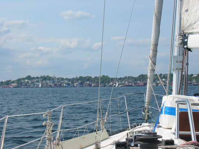 Approaching Lunenburg. |
||
| July 3, 2004 | Oak Island, NS | Once again we made a good choice to move out even though the weather had some questionable aspects. The Canadian marine radio weather forecast talked of thunderstorms and, in fact, a severe thunderstorm watch had been issued for areas east of Halifax. While thunderstorms are not uncommon in Atlantic Canada, severe thunderstorms are quite rare. We stopped by the library for Internet access to check weather and saw that our proposed course would not likely have that kind of excitement so off we went. Expecting clouds, some fog, and light wind we happily found sunshine and good sailing. It's not very far from Lunenburg to Mahone Bay and our plan was to spend the time sailing around. Mahone Bay is a favorite cruising spot for the locals and we quickly saw why. There are over 300 islands, somewhat sheltered waters, and some nice ports. We made for Chester and sailed by the Chester Yacht Club and their Saturday race, but saw they had no dockside space so we opted for the marina at Oak Island which turned out to be a very nice spot. It looked like the fog was going to close in so we pulled in about 1600 and fortunately got the last spot in the marina. There is a legend in these parts that somewhere buried on Oak Island is a treasure some think from Captain Kidd's adventures. A while ago, a manmade tunnel was discovered and when initially investigated was found to have several layers and some artifacts dating to the 1700's. A few gold coins were found as well as coconut shells obviously not originating nearby. However, when digging further the tunnel flooded and, although a fair amount of effort has been expended, the bottom of the pit has never been reached. It appears that the flooding was an intentional design feature maybe to protect the hidden treasure. At the moment, access to Oak Island is restricted owing to a dispute between the two principal property owners so we were not able to search ourselves. |
 Headed toward Chester, NS.  Erin driving in Mahone Bay.  Fog chasing us into Oak Island.  Treasure hidden on Oak Island?? |
||
| July 4, 2004 | Halifax, NS | Today we arrived in Halifax, something of a milestone on the trip. Erin will depart by air on Wednesday, June 7, and I will lay over a few more days beyond that provisioning, cleaning, and generally goofing off. Then it will be a single handed sail up to Cape Breton. It was a straight forward trip from Oak Island across Mahone Bay, past Peggy's Cove on St. Margarets Bay, through the Sambro Channel into Halifax Harbor. Along the way, we saw several porpoise, a few seals, and a possible whale sighting. We did the first part under sail on a close reach but had to tack further offshore to avoid numerous fish nets. We had good visibility so they didn't really pose a big problem to us, but if there was fog of if it was night, they could be a real pain. We called ahead to the Royal Nova Scotia Yacht Squadron to reserve wharfage since the Halifax to Ste. Pierre race was about to go off and a fleet would be gathering. No problem, we checked in and Infrared will be docked here for a week or so. It is worth noting that dockside at the RNSYS costs $50 Canadian per night, that's $37.50 US which is a little more than $1.00/foot, a price seldom seen in the US. |
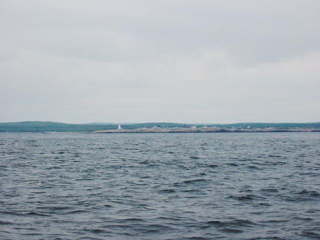 Offshore view of Peggy's Cove. 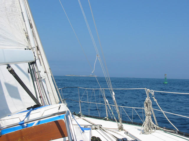 Sailing into Sambro Channel. |
||
| July 5, 2004 | Halifax, NS | The Royal Nova Scotia Yacht Squadron is located a few miles from the center of Halifax so Erin and I took the bus into downtown. They have a number of waterfront attractions, the Citadel (the fort dominating the town and the harbor), several other interesting sights, and what was described to us as the greatest number of bars and restaurants per capita in Canada. So we were tourists for the day.
|
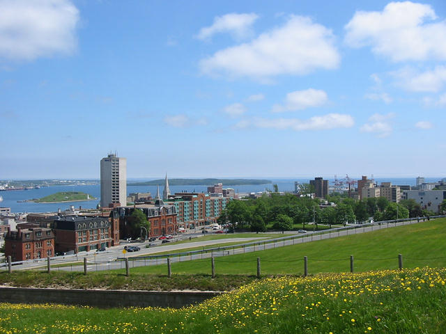 Halifax looking south from the Citadel. 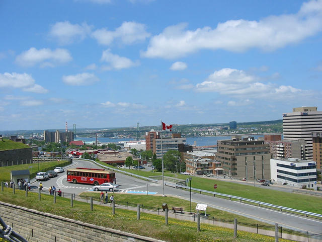 Halifax looking north from the Citadel. |
||
| July 7, 2004 | Halifax, NS | I delivered Erin to the Halifax airport this morning. We had rented a car yesterday to travel to the outlying sights and to expedite his getting to the distant airport at 0730. One cannot visit here without seeing Peggy's Cove, probably the most photographed sight in Atlantic Canada. It is the quintessential tiny isolated rocky fishing village, and it has a lighthouse! On the way we stopped at Prospect a port we had considered as a stopover since it sounded interesting in the Sailing Directions (the government publication providing details on virtually all ports and passages). Both of these little town are just what you would imagine when thinking of coastal Nova Scotia. Later on, we drove over to Chester since we had seen it from the water but not stopped there, instead opting for Oak Island last Saturday. People up here say Chester is the big sailing center in the area. Both cruising guides described an upscale attitude at the club and an aristocratic feeling to the town. Well, we were not impressed. Indeed, there are some nice houses, but also a number of very modest, maybe even dumpy, dwellings, too. The Chester Yacht Club looks run down and suggested to me that they had nothing to feel superior about. Oh, well, we had a couple of beverages at one of the two establishments in town and went back to Halifax for dinner and a search for some live music on a Tuesday night. |
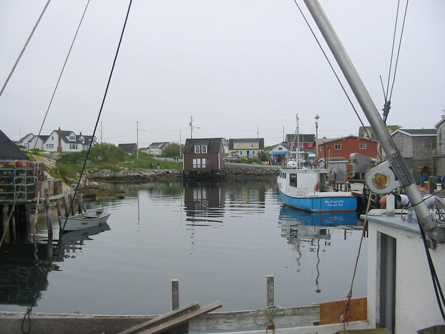 The harbor at Peggy's Cove.  The entrance into Peggy's Cove. 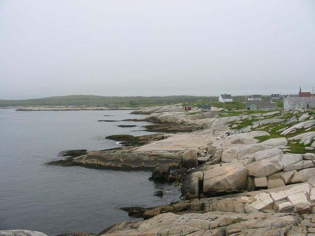 The entrance into Peggy's Cove as seen from the sea. It's just beyond the maroon shack. 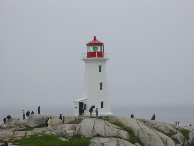 The famous lighthouse at Peggy's Cove. We had sailed just offshore past it on Sunday. |
||
| July 9, 2004 | Halifax, NS | I used the rental car yesterday morning to make a few stops and provision the boat with the heavy stuff like water jugs, booze, and soda. Then into downtown to return the car and for lunch and a visit to the Maritime Museum. To me, the most fascinating exhibit is the one about ship wrecks. Nova Scotia has recorded well over 1000 wrecks along its coasts and some think the real number is closer to 2500. The top four locations are Sable Island (a sandy spit 100 nm or so offshore), St. Pauls Island (between Cape Breton and Port aux Basques, Newfoundland), Cape Sable, and Halifax Harbor approaches. Infrared has passed all but Sable Island! There is also an extensive Titanic exhibit since Halifax was the nearest port with any sort with capability to handle the survivors and bodies from the sinking. Many of the victims are buried here. One of those seldom heard of events memorialized at the museum is the great Halifax explosion of 1917. It seems that the French ship Mont Blanc loaded with wartime munitions and 400,000 pounds of TNT collided with another ship in the harbor entrance. The munitions ship caught fire and the crew, knowing the cargo would not do well in a fire, abandoned ship. Unmanned, the ship drifted toward the wharf and exploded at around 0900. Over 2000 people were killed and some 9000 seriously injured. A significant portion of Halifax was leveled. It was the largest manmade explosion prior to the Manhattan Project producing the atomic bomb. Today (Friday) is a housekeeping day. It took a while to do three loads of laundry at a single washer and dryer. Also the boat got a cleaning and a few other repairs were made. I hope to leave for Popes Harbor tomorrow morning but the weather has been in one of those not uncommon dreary, foggy, rainy patterns so if things don't look so good I might stay until Sunday or maybe even Monday. I am doing well with the schedule and have days to play with. Sandy is to fly in on July 22 and I will rent a car somewhere in Cape Breton and pick her up in Halifax, so that's the only real deadline I have right now. |
 A dreary day on the Halifax waterfront. |
||
| July 10, 2004 | Halifax, NS | I woke up this morning hoping to see weather favoring leaving for points east but there were clouds and some fog. Furthermore, the marine weather forecast held the probability that the damp conditions would persist throughout the day. So back to bed. But a few hours later the sun was breaking through and stayed for most of the day! Oh, well, I have the time to spare so I will try again tomorrow. | |||
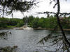
| July 11, 2004 | Sallys Cove, MS | I left the Royal Nova Scotia Yacht Squadron's wharf at 0715 to head east. It looked to be a gloomy overcast start but there was no fog, so things were looking up. After an hour motoring out of Halifax harbor, the wind perked up nicely, the sun started a string of periodic appearances, and the rest of the day was terrific! I was under sail on a beam reach with wind ranging from 5 to 22 kt from 0830 until 0330 when I doused sail to pulled into Popes Harbor looking for Sallys Cove On prior occasions, Sandy and I had stayed in Owls Head Bay near Ships Harbor which is a perfectly serviceable anchorage, but the cruising guides said Sallys Cove was a top choice so I had to have a look. Furthermore, the sailing conditions were so good that a somewhat more distant destination was welcome. What a spot! One cannot picture a more picturesque cove to throw the anchor over. Surrounded by coniferous forest above a rocky shore line and completely sheltered from any wind but due east, it was beautiful. I arrived to find another American sailboat at anchor but the cove is big enough to accommodate several dozen rum runners (which it is reported to have done in the era of prohibition). That sailboat, by the way, was only the second I had seen all day while sailing close to 50 nm. |
 The entrance to Sallys Cove. 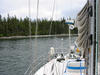 The view aft in Sallys Cove. 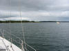 The view forward in Sallys Cove. |
||
| July 12, 2004 | Marie Joseph, MS | While there were clouds and some showers yesterday, today dawned perfectly clear; blue skies and sunshine. On the other hand the marine forecast predicted light and variable wind. So I left under motor headed for Gerards Passage, one of those narrow routes through the islands and shoals noted for scenery and shelter. It is a passage from Popes Harbor to the next bay, Spry Harbor, which is not a particular time saver for me but looked to be interesting. Well, I motored into the passage, but chickened out. Along the passage, there are two very narrow (~30 ft) places with charted depths of 7-8 ft and it was low tide, so judgement took over. Had it been high tide I certainly would have gone, but the current charts have little detail on such passages and the guide books rely on the old data so I went back around. Anyway, it was a pleasant surprise that the wind did indeed come up for a very nice sail along the Inside Passage (as the route inside the islands and shoals is called). I was in no hurry, so was perfectly content to sail along under bright sunshine at 4 - 5.5 kt on flat seas due to an offshore westerly breeze. It was the first day that I sailed in Canada without long underwear and only putting fleece on occasionally. Once again, I am following the advice of the cruising guides that suggested Marie Joseph as a scenic place to anchor over. I found the large expanse called Marie Joseph Harbor on the charts to be nice but full of aquaculture lines, traps, or whatever they call that crap waiting to foul the rudder and propeller, so I pulled into Hawbolt Cove where the actual town is located. It's a nice sheltered anchorage (the town consists of 4 or 5 houses and a fishing wharf). I am staying on the boat. |
 The village of Marie Joseph. 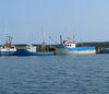 The fishing fleet of Marie Joseph. 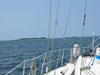 Islands along the Inside Passage. |
||
| July 13, 2004 | Liscomb Mills, NS | So when I carefully looked at the charts, I saw that Liscomb was not that far from Marie Joseph. Actually, if one were to trek overland, it's only a couple of miles. By sea, it's about 10 nm. That being the case, I certainly didn't have to arise with the rooster to get underway. When I did pull up the anchor it was almost ten o'clock, but by the there was a breeze coming up. I motored slowly eastbound out of the Inside Passage both out of caution but equally to absorb the sights. When I was beyond the last caution marker, I raised the sails but there was no fun in sailing immediately into Liscomb so I headed out to sea just for fun. With 12-18 kt on the beam, it was a rocking good time. About six miles out was a fairway buoy which made for an appropriate windward mark so I rounded it and headed back for shore. At this point, I noticed another sailboat a few miles southwestward. It's so unusual to see other sailboats (as well as any other boats at all) that I couldn't help but pay attention. Upon further inspection however, I decided he must be motor sailing since his downwind course could only be sustained with a spinnaker or maybe wing on wing, neither of which he was doing. So I lost interest. As I approached Liscomb Light at the harbor entrance, I expected to be sheltered inside the headlands and have an easy time dousing the sails. Well, that was not to be the case. The wind picked up in the harbor and made the douse a rodeo cowboy exercise. Under motor, I then headed for the Liscomb Lodge which is a few miles up into the Liscomb River. This is a very scenic route. It's a rare event when a sailboat can make its way up a 40 yard wide river with trees on both sides and end up at a wharf at a first class lodge. And to make things even better, there was no one else at the wharf and that lodge is very reasonable about price. As I write this, I am planning to stay here at least one additional day just because it's a great place, but since the weather situation looks less than perfect it may be longer. It would sure beat getting stuck by weather in Atlantic City! |
 Liscomb harbor lighthouse under sail. 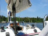 The Liscomb Lodge is in sight. |
||
| July 14, 2004 | Liscomb Mills, NS |
Today I paid up for wharfage through Thursday night hoping to leave Friday morning. This afternoon was very windy with parts of that storm that hammered the mid-Atlantic US with heavy rain passing slowly to the south. So far, not much rain here but 30-35 kt easterlies offshore. The forecast for strong southwesterly to southeasterly winds to follow means heavy fog for tomorrow so I'm staying. In this neighborhood, fog is a bigger problem for me because, even with radar and GPS, the harbors between here and Canso (and including Canso) are very difficult to enter in bad visibility so if I get out to sea and things close in, finding a bail out harbor becomes a hairy proposition.
On that same subject, it should be noted that this part of Nova Scotia is the least populated of the entire province. The big town nearby is Sherbrooke with a population of 400. I had a nice conversation with the bar maid last evening during which I asked her about the size of Liscomb Mills. She said there was her house, her sister's house, and one other house...that's it. So I asked about Liscomb itself. She said that Liscomb was a location not a town! That being the case, it's not the place to expect help if you get into trouble. If houses are rare, imagine how many rescue boats there are. I took a bit of a hike around some of the nature trails and its quite the spot. The Liscomb Lodge itself is a very nice place out here in the middle of nowhere. It is run by the province of Nova Scotia and I can't imagine it's profitable. The facility is large both in capacity and expanse (the marina excepted as the photos show) but it appears to be far from filled here in the height of the season. I would definitely recommend coming here by land if you want a very comfortable reasonably priced getaway (and I mean an real getaway...perhaps a hideout!). I like it and hope to return of the way back. |
 Infrared resting up at Liscomb Lodge. 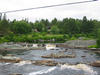 Falls on the Liscomb River just above the lodge. |
||
| July 16, 2004 | Liscomb Mills, NS |
Up until this morning the weather situation looked promising for an early departure, but it was not to be. That low pressure system that initiated this spate of weather passed to the south but faded and was absorbed into a stronger system to the west. That system is still active enough to keep a southwesterly wind blowing 20-25 kt and it also means plenty of fog. I was up at 0630 and I couldn't see 100m down the river and after waiting until 1000, it was not improved. Couple the bad visibility with brisk winds offshore and six foot seas, and you have a less than ideal day. Tomorrow, the southwesterly flow will undoubtedly mean the fog persists but with the wind diminishing significantly, I expect to make it to Canso 65 nm away. So far, I have been very fortunate with the weather, so putting up with a damp day of motoring at this point isn't so bad. Sandy is due to fly in next Thursday and I plan to be in Port Hawkesbury where I am assured that I can rent a car to pick her up in Halifax. Port Hawkesbury is only 30 nm beyond Canso, but it looks like another rain maker will be on the scene on Monday, so I want to get in the neighborhood soon. |
|
||
| Sunday July 18, 2004 |
St. Peters in Cape Breton, NS |
It was a hairy trip to get here. I left the comforts of the Liscomb Lodge yesterday (Saturday) morning figuring that the persistent southwesterly fog generating wind was here to stay and I had to negotiate in it. I set out for Canso, a distance of 65 nm away, but wasn't able to get visibility to get out of the river until almost 1000 hours. Sure enough, there was thick fog all day and wind on the stern at 15-18 kt, not enough to sail at speed but enough to get the following sea up to six feet. Once out in the ocean, it wasn't so bad. There are no real obstructions and with a periodic look at the radar for traffic, the lack of visibility was more boring than worrisome. I passed four vessels in the fog, three of which I think were sailboats perhaps returning from the Halifax to Ste. Pierre race. I heard them yaking on the VHF but kept a low profile (homeland security, you know). The really interesting thing was that in the terribly limited visibility I saw, what I believe from my guide book to be a very rare Leatherback Sea Turtle. He was paddling by about 30 m off my starboard gunnel and seemed happy to be in the fog! Shortly thereafter, I had to grab the wheel to avoid a basking ocean Sunfish. These are huge slow moving creatures that can get up to 4400 lbs, so you really don't want to hit one. The real fun began at the end of the day as I pulled into Andrew Passage. This is a route through some formidable shoals and islands that cuts off the worse of Canso shoals. In fair weather, Sandy and I had passed through this passage twice with no sweat. I, on this occasion, was figuring that the fog would abate as I proceeded inland so I would be able to see. So I doused the sails, and headed inward with radar and the paper chart as principal guidance (the C-Map charts don't have the resolution to be very helpful for this). Well, the fog had no mind to abate and I found myself in a progressively narrowing passage with Canadian buoys that are so damn small that Strategic Air Command radar couldn't find them. But I did find the first pair and thought I had it under control. Fat chance! There I was between a red and a green buoy when the keel bounced off a Nova Scotia rock! What to do? I had identified a cove (Portage Cove for those following on their home charts) as a bail out position. Since I still had no visual range, I turned and tried to get there. Whew, it wasn't easy! After touching again on Haulover Shoal, I was happy to be throwing the anchor over in Portage Cove. Today (Sunday) morning I saw that the fog was as thick as last night which posed a problem since there is a storm already scheduled to blow through here tomorrow. So I am a bit concerned that I may be stuck in this cove for two more days. By then, I was sure Sandy would have declared me dead and filed for the insurance, so I needed a plan. I laid out a detailed set of GPS steps to get through the passage blind, but, while doing this, the fog did lift just enough for some visibility. So up with the anchor and VERY slowly did I maneuver through the passage. Once out of Andrew Passage, I decided that poor deprived Canso was no place to wait out a rainy day (we did that on the last trip) so I headed across the Canso shoals for St. Peters which is just inside the Bra d'Ors Lakes, a far better place to be rained upon. So I am there now in one of the finest marinas one could hope to visit! |
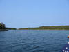
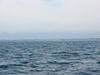 Leaving Canso behind on the way to St. Peters. 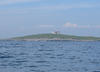 Green Island light on the way to St. Peters. 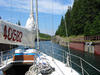 St. Peters Canal. |
||
| Monday July 19, 2004 |
St. Peters, NS |
It has, indeed, been the rainy day that was expected. Probably there will be well over an inch, maybe two, by the time it breaks. This is good news locally since, although by no means is it a drought, they do need rain. My timing in getting here turned out to be fortunate. When I arrived, at about 1530, there were many empty slips at the marina. Well, over the next couple of hours, boats poured in! All of the slips are now full and there are another 14 or 15 sailboats either moored or at anchor in the small bay. Looks like everyone in the vicinity was looking for the same thing I was: a good place to wait out a rainy day.
I am quite happy to be here rather than some of the alternatives that were taking shape a few days ago. St. Peters Marina is a first class setup with one of a select cadre of excellent Nova Scotia dock managers. Gerry Gibson is a great guy and will try to do anything to help you out. When I told him that I planned to go over to Port Hawkesbury and leave the boat there while I rented a car to retrieve Sandy in Halifax, he pointed out that the marina facility in Port Hawkesbury is in sad shape not having recovered from last season's Hurricane Juan. Instead, Gerry suggested staying here and he would take me into Port Hawkesbury, if necessary, to pick up and return the rental car. I said I'd think it over, so he offered to take me with him today into Port Hawkesbury (he had a couple of errands to do) and we'd go check out the marina. Yes, the marina is rather beat up and it is a much better plan to stay here until the weekend. I reserved a car and National actually will pick up and drop off for an extra $25, so we are set. While on our road trip, Gerry took me over to Isle Madam so I could see for myself that the bridge in the Lennox Passage is a draw bridge and I ought to consider Lennox Passage as the route over to the Strait of Canso to get to Prince Edward Island. This is why it's so worthwhile to ask local folks for advice. I had thought the charts showed a fixed bridge and dismissed the passage long ago. Now, we can actually make it from here to Ballantynes Cove in a day. (All of these places can be appreciated by looking at Canadian Charts 4335 and 4462 available at Maryland Nautical Sales in Locust Point. Ask for Brian or Terry and tell them I sent you!) |
 Raining in St. Peters. |
||
| Saturday July 24, 2004 |
Port Hawkesbury, NS | I hadn't realized that it has been several days since the last update. I fell into the lazy, cruising frame of mind and was perfectly happy to let the days drift by while at the marina in St. Peters. I did rent a car and pick up Sandy in Halifax last Thursday and we returned to St. Peters on Friday (yesterday). We had a great time last night with the other Bob and Sandy, that is, the Lajoies (lezch-wa) who had entered the canal at the same time I did last Sunday, on their power boat, and were planning on simply spending a couple of weeks hanging about. They live in Guysborough, across Chedabucto Bay and do this at least once a summer. So Sandy and I did leave today at 1300 for the 25 nm trip through the Lennox Passage and actually had some pretty good sailing. Very flukey winds in the passage but managed well. There is that drawbridge which meant lowering sail and motoring through, but we put the sails back up and, with a double reef, went happily into the Canso Straits. We doused the sails in a lull that looked like the prelude to some gusty showers and that turned out to be a good decision. We plan to be out of here tomorrow for Ballentyne Cove, another easy daysail across St. Georges Bay. From there we will decide whether to strike out for Iles de al Madeleine right away or go toward Pictou and Charlottetown and wait for a better weather window. At the moment, the weather does look promising for Iles de la Madeleine. |
 Out of the Bras d'Ors Lakes heading for Port Hawkesbury and eventually Prince Edward Island. 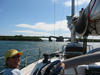 Sandy in Lennox Passage.  Bob driving in shorts in Nova Scotia! 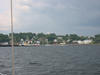 Arriving in Port Hawkesbury in the Straits of Canso. |
||
| Sunday July 25, 2004 |
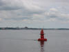
Ballantynes Cove, NS | Since this was a fairly short trip from Port Hawkesbury to Ballantyne Cove (~26 nm), we left at the leisurely hour of 1030. The first stop was the Canso Locks where we needed to pass under a pivoting bridge and then enter the locks that control the flood of current through the Canso Straits. We are tied up in Ballantynes Cove tonight with a few showers and the usual Atlantic Canada overcast and showers. Tomorrow we expect to leave for Soris, PEI, a jumping off point for the Iles de la Madeleine. |
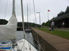
 Entering the locks in the Canso Straits. 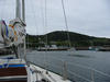 Arrival in Ballantynes Cove. |
||
| Tuesday July 27, 2004 |
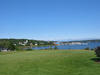
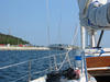
Iles de la Madeleine, Quebec | We have arrived in the Iles de la Madeleine, the most distant location on the itinerary. We had left Ballantynes Cove at the tip of St. George Bay and crossed the Northumberland Strait to PEI for an overnight stopover at Souris (pronounced Sor-ee). This is a ferry terminal and fishing port with no marina, so it was a night tied up to the government wharf and an 0510 early departure for the 70 nm trip to the Magdalenes (the English name for these islands). We decided to come here right away since the weather appeared to pose no threats for a 5-6 day period and then tour PEI afterward. The passage was a motoring event. The waters were very calm until early afternoon when a 10 kt south wind came up. It was no good for sailing since it was directly astern, but did manage to push a 1-2 foot following sea. We arrived exactly 12 hours later and received a nice greeting from the dockmaster who showed us to our slip. Although the cruising guide suggested that the southern most island Harve Aubert was a better stop, Cap aux Meules has the most substantial marina on the islands. We have subsequently found out that there is less than 6 feet at the Harve Aubert marina so although a more scenic spot, wouldn't do for us anyway. The Magdalenes are very different than I expected. Instead of being remote, isolated, and sparsely populated, They are still remote, but visited daily by ferry from PEI and every few days from Montreal and Quebec City, and there is a population nearly 70,000 in the summer! It seems this is a huge vacation destination for eastern Quebec - rather like the Ocean City of Quebec. |
 Souris, PEI 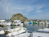 Cap aux Meules. 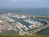 The marina in the town of Cap aux Meules. |
||
| Wednesday July 28, 2004 |
Iles de la Madeleine, Quebec | Having briefly walked about the immediate vicinity of the marina last evening and found things spread out beyond our reach, we decided to rent a car to see what else is on these islands. Hertz has an office close by and you figure that an American company would not present a language problem. Things did work out and we went off for Harve Aubert so see both the town and the marina (that we chose not to visit.) Harve Aubert is, indeed, a far more attractive setting that Cap aux Meules. It is now resurrected into a tourist center with brightly colored rehabilitated buildings that contain eateries, souvenir shops, and educational displays. But the real beauty is in the coast, landscape, and natural features surrounding the village. It was at this point that we visited the marina. They did a great job of constructing solid floating wharves and have nice facilities, but they couldn't overcome the shallow water. These are shifting sandy bottoms and when we asked two of the sailboats in the marina about depth, both showed 5.25 ft on their depth gauges. Boy, that would have been a nuisance for Infrared and her 6.5 ft keel! There is no doubt where the Quebecois stand on the language question. Although Canada is by law a bilingual country and the maritime provinces have gone to great pains to have bilingual signage and labeling, there seem to be many Quebec people who couldn't care less about English. We have gotten along adequately, but often it isn't easy. Those stories you heard about people who can speak English but won't, may be more about the Quebec'ers than the real French. |
 Harve Aubert in Iles de la Madeleines. 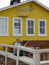 What those historic fishing structures are used for now. 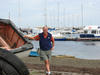 Bob sees the marina he didn't sail into. 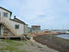 Beach front in Harve Aubert. |
||
| Thursday July 29, 2004 |
Iles de la Madeleines, Quebec |
With our orange-brown rental car we were tourists today. First we explored the island where we are living, Cap-aux-Meules, driving to the western shore. That's only about a three mile trip but upon arriving at Belle Anse, we found the most spectacular view of the famous Iles de la Madeleines red cliffs. (Maybe that's why they gave us the orange-brown car?!). These are featured in the publicity for the islands and rightly so. It's quite the sight and hardly anyone around to crowd the view. Next stop was the community of L'Etang du Nord which is now a spot where artists of the island (or, at least, a few of them) show their stuff. Now we didn't know this as we wandered into the village, but it turned out nicely. There was a little cafe with an outdoor table for lunch (avec vin blanc) and a few boutiques with some art and also the customary tee shirt shops. I found no imaginative tee shirts in French so we left empty handed. We had gotten some tips on restaurants and a cheese shop from some knowledgeable folks so went off to the north, along the way checking out the tips. The cheese shop was a great spot. Very small, they sell only their own cheese made on their farm from their cows. There were only two kinds, translated to "hard cheese and soft cheese" for the Americans, but we bought some of both and were pleasantly surprised. On to the northernmost island, Ile Grand Entre. When we got there we could see that it was definitely out of the mainstream tourist loop. The marina is huge but virtually all fishing boats (one lonely sailboat was tied up at the wharf). It seemed that there were several times as many boats at the wharf as there were houses in the village! We ventured out to the shore away from the village and found some more very scenic beaches among the red rocks. Unfortunately, there was a bit of fog that had closed in so the view was less than ideal. |
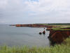 The famed red cliffs of the Madeleine. 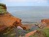 Red cliffs being changed as we watch. 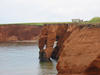 More of the red cliffs. 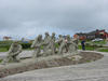 Pitching in to help out at L'Etang du Nord.  Fishing wharf at L'Etang du Nord.  The beach at Grand Entre. |
||
| Sunday August 1, 2004 |
Chéticamp, NS |
Last Friday, we ran errands, resupplied the boat and returned the rental car in Cap-aux-Meules with the hope of departing on Saturday. Well, were we dreaming! Upon arising at 0500 for the 70 nm trek back to Souris, we found the wind howling from the south (our intended course direction) at 15-30 kt and this already at dawn! Recognizing that the wind usually increases as the day goes along, we decided Cap-aux-Meules was far preferred over a truly nasty slogging passage. So Sunday, we tried again. And once again, at 0500 the wind was howling. We went back to bed and got up again about 0900 and were hanging around the wharf (since we had no vehicle and had seen enough of the local sights) when the winds died to only 15-20 kt just before noon with a forecast for a southwesterly direction. So we decided we had to get going. I had a backup plan if the wind was too southerly for landing in Souris and that was to sail southeastward to Cape Breton and go to Chéticamp. It was a great plan except for the fact that I hadn't the charts for Chéticamp. Realizing that back on Thursday, I went to the local chart purveyor and got the medium scale chart but he didn't have the small scale chart of the harbor. He did allow me to study his electronic charts, so we would be heading for Chéticamp with a sketch of the harbor and its tricky channel on a piece of loose leaf! And, sure enough, we exited the archipelago that makes up the Iles de la Madeleines and the wind was not southwest, but close enough to south and at 15-25 kt that we had to veer off to Chéticamp, about 50 nm away. It was hard on the wind sailing, with 3-5 foot seas. The surest phenomenon in sailing, I have found, is that the wind, when it recognizes what you want it to do, will take countermeasures. About 1600, the wind shifted enough to the southeast to drive us off of Chéticamp. Not wanting to enter a strange harbor in the dark (not to mention that loose leaf chart), we fired up the motor to force the issue. We motored slogged with water over the bow and a constant 18 kts of headwind, arriving in the harbor in twilight but able to see those marks on the loose leaf chart. We dropped anchor in the lee of the government wharf and Sandy whipped up a terrific dinner during which the wind suddenly picked up to 25-30 kt! We had arrived in the nick of time. It blew that way the whole night but the muscular Fortress 16 anchor was up to the task and we were secure through it all (although Sandy felt obligated to keep watching to be sure). There was no way we were going out in that when morning came, so we moved to the wharf and tied up to one of the fishing boats. When there is no room at the wharf, the custom here is simply to raft up to one of the fishing boats. We were told that the fishermen expect it and, if they need to move, they will move your boat if you are not around. This was the first time we had actually tried it however. While pulling toward the wharf, a couple of the fishermen saw us and jumped on board our target boat and helped us tie up, something we took as a sign of approval. This spot was the best situated for shelter from the wind and, luckily for us, was about the only boat on the wharf not preparing to got out for snow crab the next day. With Infrared safely hidden from the gale, we headed for town. There is a big Acadian community here and this year marks the 400th anniversary of the deportation of the Acadians (for places like Louisiana to become Cajuns). I'm not sure why that's a cause for celebration - forced deportation seems to me an event to be lamented, but they are making a big deal out of it here, and I try not to ask hard questions of French-Canadian people. Anyway we had a pleasant day in Chéticamp waiting out the gale. |
 Infrared hiding from the gale in Chéticamp, NS. 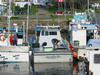 Loading for snow crab. 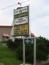 Where to dine in Chéticamp. |
||
| Tuesday August 3, 2004 |
Montague, PEI |
Fortunately, I am more than 24 hours removed from the events of yesterday as I write this and in a relaxed frame of mind here in Montague. We again had hoped for an early departure time from Chéticamp Monday morning, but found stiff winds in the harbor in the pre-dawn twilight. The Canadian Marine Weather forecast insisted that the wind would soon become light and variable over our proposed route across the Northumberland Strait so we decided to leave to go to PEI. Whether we went to Souris or to Montague would depend on wind, but we were hoping to go to Montague. The wind was 12-18 kt as we got beyond the headlands and turned southwestward but the sea was nastily churned up by the last 48 hours of 25-30 kt wind so it was the 3 to 6 foot seas predicted by the marine forecast. We took a course for Montague and slogged through the pounding seas hoping for a break. This was painful but, the forecast actually came true in the mid-afternoon as the wind died and the sea actually became almost flat. |
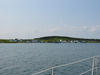
 Finally some nice air going into Montague. 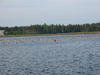 This is where the PEI mussels that we eat at Hull Street Blues come from. |
||
| Wednesday August 4, 2004 |
Montague, PEI | We have been spending time wandering around the village attending to various chores and enjoying the most summerlike conditions yet encountered. Montague is a very nice small town with virtually all amenities we need. I had envisioned PEI as being perhaps a bit more rustic, but we have noticed that most of the neighborhoods we have seen here could just as well have been in Howard County. The economy appears good and the standard of living is equal to American standards. |
 Getting a "Tuna Cut". 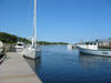 At the Montague Marina. |
||
| Thursday August 5, 2004 |
Wood Island, PEI |
So the plan seemed perfect at the time: leave Montague in bright sunshine and blue skies with a forecast of a northwest wind at 5-10 kt with the ultimate destination of Charlottetown on Friday with an overnight stop in Wood Island. Wood Island is the PEI terminus of the ferry line and is not much of an attraction other than a convenient stopover on the 60 nm trip to Charlottetown. The most able dockmaster at Montague, Jock Beck, confirmed that there was enough water in the small craft area for Infrared to tie up, so off we went for an easy day. Well, nobody had warned us about Cape Bear. This aptly named southeast corner of PEI is locally known (but not known to Marylanders) for its surprisingly troublesome sea conditions. Here we had the current with us as we rounded to Cape turning westward, but the expected light northwest wind quickly turned into a strong westerly blow. Under motor, we found ourselves in a 20-25 kt head wind but against a strong current. This is the textbook situation (strong wind opposing strong current) for nasty seas. For the next three hours, we slogged, in the most meaningful sense of the word, through 6 foot, very steep and frequent waves. The poor 20 hp Yanmar was struggling to maintain a couple of knots of speed through the water, but that added to the almost 2 kt of current, did move us forward. We were very pleased to reach the shelter of the Wood Island Harbor. The small craft harbor is sparse; we tied up to a steel wharf with 6 foot tidal variation and no ladders. I had a delicious (rock) crab sandwich at Crabby's fish shack run by Kip "Crabby" Smith who also collected the $10 CAN wharfage fee. |
 Releived to be at Wood Island. |
||
| Friday August 6, 2004 |
Charlottetown, PEI |
In addition to the giant ferry boats, Wood Island harbor has an additional endearing feature: massive quantities of sea grass floating around the wharf. It was inevitable that we ingested some of it into the engine cooling system so we needed to unclog the water trap and intake line before leaving. Fortunately, the effect of the clog was noticed while still in the harbor rather than some time later out to sea. There was no real wind so the 28 nm jump to Charlottetown was a fairly short motor hop. A big feature was the significant current in the Northumberland Strait which was in our favor. In all of the reading and talking to locals about these waters, never was the current mentioned and, so far, it has turned out to be biggest planning consideration. We were gaining a full 2 kt of lift around Prim Point. Oh, well, we arrived in Charlottetown and tied up at the Quartermaster Marina a few short blocks from the center of town. We will be here for several days. |
 Carried by a favorable current into Charlottetown. 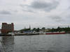 A sheltered spot in Charlottetown. |
||
| Sunday August 8, 2004 |
Charlottetown, PEI |
Saturday was a rainy day, but we were already here with the boom tent up so it went as well as a rainy day can. We did some walking about, making three trips to various internet access sites since the rickety laptop sometimes doesn't copy files completely (when it copies them at all!). From what we have seen so far, Charlottetown is a very attractive place. Much like Portland, Maine, and Halifax, there is a very active cafe and music scene in the center of the city. Many of the classic old buildings are now spruced up to house shops and restaurants. There aren't any pure bars, however. Provincial law only allows adult beverages to be served with food, so massive amounts of bread sticks are sold here. Canada had prohibition just like the US, complete with rum runners and bootleggers, but PEI didn't repeal prohibition until 1948! A rental car has been arranged for tomorrow morning so we will spend today trying to set up a tourist itinerary for seeing the rest of the island. |
It rained all day yesterday, so no new pictures.
|
||
| Tuesday August 10, 2004 |
Woodstock, PEI |
So we did rent a car (a bright yellow Mustang convertable) to see the island and off we went, stopping first at Victoria. This is a neat little town with an unexplainable artist attraction. The whole village consists of maybe thirty dwellings but here were a dozen art shops, cafes, and bed & breakfast places all with a healthy clientele! They must have the best PR firm in Canada, it was certainly nice but why were all those other people there...I don't know. While at Victoria we overheard some folks pointing to the west and saying there was a funnel cloud dropping. It was a water spout that crossed the Confereration Bridge, the only bridge linking PEI with mainland North America. We saw the same cloud complex a bit later at the bridge and it still looked pretty hearty. As we moved further westward, we neared the Confederation Bridge and arrived just in time for the next convective episode. We saw some pretty heavy downpours but once a few miles past the bridge it cleared out again. The southwest part of the island is identified as Acadian, so we approached it with a skeptical eye owing to our experience in the Magdelenes. We rode through several scenic locations identified on the map as something but most were imaginary towns i.e. a house or two and no place to get a chili dog. Later in the day we found the resort at Mill River and they had a room so we signed up. It was a nice spot pretty much an oasis in the rural landscape and reasonably priced. PEI is big golf contry and this was one of the resorts. |
 The perfect rental car for PEI. 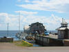 The most popular Victoria wharf. 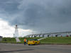 Some wild weather near the Confederation Bridge linking PEI with the rest of the world. 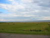 The agricultural bounty of PEI extends to the sea. |
||
| Wednesday August 11, 2004 |
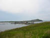
Cavendish, PEI | After checking out of the Rodd Mill River Resort, we excitedly headed for the PEI Potato Museum in nearby O'Leary. It's hard to guess what to expect at a potato museum, but this one turned out to be pretty good! Since potato farming is a major (if not the major) economic activity in the island, they take the potato seriously. We learned about the history of the potato (it originated in South America), the different varieties, and the feared Colorado Potato Beetle. By lunchtime we had made our way to North Cape, the northernmost point on the island. There is an experimental wind power farm operated by the University of New Brunswick with ~20 giant propellor generators. It wasn't that windy while we were there and the generators were moving and completely quiet. North Cape has a the largest reef in the region extending northward into the sea. It didn't look that frightening from land. During the afternoon we moved along to the north central coast, a region famous for the Anne of Green Gables series of stories. Along the way, we passed many spectacular churches and stopped at St. Mary's Roman Catholic Church in Indian River. Later on, we stopped at one of the beaches which we had been told were the prime attraction for most tourists coming to PEI. These were interesting in that, indeed, people do go in the water here in Maritime Canada, but we still thought the water was cold! On the final approach to our motel we stopped at the birthplace of Lucy Maud Montgomery, the author of the Anne of Green Gables stories (it was on the side of the road we were on). Later on we ate at Thirsty's in Cavendish.
|
 The PEI Potato Museum. 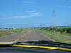 A view along the northwestern shore of PEI. 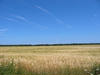 Wind power generators at North Cape, PEI.  Checking out the cliffs at North Cape, PEI.  St. Marys Church. 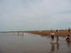 Beach Scene. 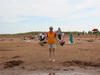 Sandy expresses her interest in PEI swimming. 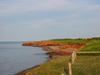 The beaches can be beautiful! |
||
| Thursday August 12, 2004 |
Charlottetown, PEI |
We arrived back in Charlottetown late in the afternoon and returned to the boat after starting the day in Cavendish on the north shore. The first stop of the day was at the Anne of Green Gables Provincial Park, just a short hop from our motel. The character, Anne, is fictional but the house is a real place. The Province is cashing in on the big tourist draw and maintains the original house and out-buildings. It was worth a drive-by, but we didn't pay for the full tour. Also of interest on the north shore are the beaches most of which are protected and public with a park encompassing the area. We drove along the coast road through the park, stopping several times to walk to the beach. We came across a spectacular structure that, at the turn of the twentieth century, was the summer home of the chairman of Standard Oil of Kentucky. It is called "Dalvey" and is in the fashion of the big summer places in Maine other tycoons of that era built. Now it is a provincial historic site with a luxurious inn and restaurant. We wandered further east along the north shore to St. Peters Bay (not to be confused with St. Peters in Cape Breton) and from there south to Cardigan and Georgetown. Both towns are in the vicinity of Montague but we didn't visit by water so we stopped by by car. Cardigan is like a smaller Montague with a new floating dock marina and mostly residential surroundings. Georgetown, on the other hand, is a real working town with a large sawmill and a shipyard that specializes in building ocean going tug boats. It was the most non-farming, non-fishing industry we have seen here. |
 The actual House of Green Gables 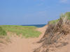 A beach scene in the park near Cavendish. 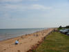 More beaches.  Classic MGB. 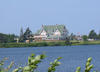 Some summer cottages are bigger than others. 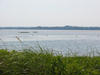 Maryland's state birds on vacation in PEI. |
||
| Saturday August 14, 2004 |
Charlottetown, PEI |
We had intended to leave today for Pictou but have been delayed. The locals tell me that its unusual for the wind to be as persistently strong as it has been. For most of the past week, we have had near gale winds from the south or southwest for at least a portion of each day. Interestingly, the wind comes up before dawn, blows like crazy until midday and sometimes settles down until evening. Today, it looks like it is going to blow through the afternoon. Tomorrow, the wind is likely to turn northwesterly which, while rather behind us, will at least not be a hinderance. The other consideration is the arrival of the remnant of Hurricane Charley which might pin us down on Tuesday, in which case we would rather be in Pictou than in Ballantynes Cove. |
 Victoria Row with street side pubs. |
||
| Monday August 16, 2004 |
Pictou, NS |
We left Charlottetown yesterday with bright sunshine and blue skies and a nice west wind that came up after we emerged from the headlands. It was a broad reach to almost a following wind for the next several hours, some good sailing. Eventually the wind diminished enough that we required a motor assist until se could turn more southerly when approaching Pictou so we did sail into town. The spot reserved for Infrared at the marina was just in front of a trawler and we ended up socializing with the folks who were from Atlanta but were living on the boat in Shediac, new Brunswick. They had had a couple of rough days in heavy seas getting to Pictou on their westbound trip. Unfortunately they took advantage of today's calm seas to leave. After a few morning chores, we plan to look around town this afternoon. |
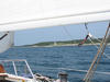
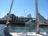
 Sandy on watch in the Northumberland Strait. 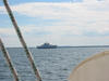 One of the two ferry boats on the route between Nova Scotia and Prince Edward Island. 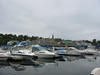 The town of Pictou, NS. |
||
| Tuesday August 17, 2004 |
Pictou, NS |
This morning it rained heavily so it looked like another day in Pictou, but we had planned for the residue of Charley (or is it Charlie?) to generate some rain. About the time we resigned ourselves to a rainy day, the rain quit and the sun came out. By then, we were staying another day in Pictou, which was alright. Yesterday we toured Pictou by walking around, but that's good enough in a small town. Pictou often compares itself to Lunenburg and there are some similarities. Both are on hillsides and both have active shipbuilding businesses, but Pictou is Ľ the size of Lunenburg. The town is trying to establish itself as a tourist destination by promoting its history as an entry point for Scottish immigration. There is a monument to the ship Hector which landed some 180 immigrants in 1840-something and the town has invested considerable effort in showing it off. There is a re-creation of the ship and a sparse, but very new, museum for the Hector colony right next to the marina. We found it interesting but not all that convincing. Those Hector immigrants were not the first, nor were they sufficiently numerous to be more than another incremental contribution to the immigration wave. But don't get me wrong, Pictou is a nice stop. There are shops, restaurants, and congenial people making it very worthwhile. |
 Pictou, Nova Scotia. 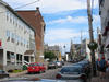 A view on the main street in Pictou, NS. 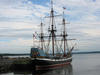 Pictou's main tourist attraction. |
||
| Wednesday August 18, 2004 |
Ballantynes Cove, NS |
We moved on from Pictou this morning with blue skies and light winds bound for Ballantynes Cove at the head of St. Georges Bay. It's a presentable stopover spot on the way back to Cape Breton. We had stopped here on the way out, but this time it seems much nicer. While in Pictou, we found Erwin and Diane Wanderer and their 43' sloop Ocean Wanderer pulling onto the wharf just behind Infrared. We first met them while we were land cruising in the yellow Mustang and they were docked in Victoria, PEI. We had quite a nice time in Pictou and we sailed together heading out for Ballantynes Cove - well, it really turned out to be a 30 nm motor cruise, but the water was flat, the motoring was easy, and Infrared actually did get to sail for the last hour or so in some light air. |
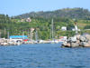 Ballantynes Cove, Nova Scotia with Ocean Wanderer at the wharf. 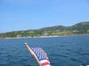 A wider view of Ballantynes Cove. |
||
| Thursday August 19, 2004 |
Port Hawkesbury, NS |
We just arrived back here in Port Hawkesbury, NS having left Ballantynes Cove about noon. The morning wind was not favorable and at odds with the prediction so we waited until it turned southerly to southwesterly. It's only about 30 nm from Ballantynes Cove to Port Hawkesbury so we could have left as late as early afternoon and make it in daylight. We did sail most of the way even though the wind never did make the predicted southwesterly 20-25 knots, it was more southerly (close reach) at 10-15 kt. Infrared passed through the Canso Locks and the swinging bridge without a hitch, but struggled to back into the marina slip as the wind puffed enought to provide excitement. |
 Heading back through the Canso Locks. |
||
| Friday August 20, 2004 |
St. Peters, NS |
The morning in Port Hawkesbury was not a pretty sight. Yesterday's sunshine was replaced by foggy, overcast, and windy conditions. The good news: no rain. The bad news: >20 knots of wind up the strait. It was a shock to see one of the Staten Island Ferry boats tied up across the strait. Had he missed a turn near the Battery in the fog? We beat our way south bound for about two miles before turning eastward to Lennox Passage, the route to St. Peters. With a double reef in the main and only a sliver of headsail rolled out, we were easily maintaining 6.5 kt in the 15-25 kt wind. Fortunately, after turning east, we were on a beam reach so it wasn't that nasty. Unfortunately, there was enough fog to detract from the view we had on the way out. At noon, we reached the draw bridge in Lennox Passage and when we hailed the bridge tender we received no answer. Knowing that, sometimes, Canadian civil servants adamantely adhere to a noontime lunch hour, we had no choice but to stand to and have lunch ourselves. It turned out to be not so bad. After about 20 minutes, the bridge tender emerged from a house nearby, got into his pickup, and drove to the bridge and opened it. It had occurred to me that, perhaps, the strike threatened by Canadian Parks employees would mean the bridge wouldn't open at all! So it was a relief of pass through. Well, we weren't so lucky when arriving at the St. Peters Canal. The strike was in force and the tenders were not able to open the lock and bridge so we could actually get into the Bras d'Or Lakes. It seems that the picketers were descending on various facilities on a more or less weekly rotation and Friday is the day to shut down the canal. All we could do was to tie up to the canal wall and wait until morning. What the strikers hope to accomplish by closing parks and other recreation facilities at the height of the vacation season escapes me. Anymore, tourism is about the only industry in most of Atlantic Canada so enraging current and potential future customers is idiotic. I would fire the whole lot as Reagan did to the striking air traffic controllers. |
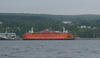 The Staten Island Ferry in Port Hawkesbury, NS!!?? 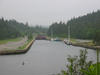 Infrared waiting for the striking park employees to open the St. Peters Canal. The crew was grumpy. |
||
| Saturday August 21, 2004 |
St. Peters, NS |
We were the first inbound vessel through the St. Peters Canal this morning after strikers had shut it down yesterday. As usual, the Lions Club Marina in St. Peters was efficient and cordial in assigning us a slip and getting us settled in. This facility is number one on my list for the quality of facilities and service, price, and scenery. The topic of the day, however, is the weighty one of planning the next couple of weeks. Sandy is due to fly out of Halifax next Friday (August 27) and Jay Redding will be arriving a week later (September 3). I was planning to rent a car and deliver Sandy to Halifax and stay up here and sail a while before taking Infrared down the coast to Halifax to meet Jay. The weather, however, has been less cooperative than in 2002 when, by this time of the year, the persistent southwesterlies weakened and were well mixed with sailing-favorable northwesterlies. Since the course back along the Nova Scotia coast (and most of the US coast for that matter) is southwest those northwestern winds are the difference between painfully and slowly pounding through big waves and headwinds or pleasantly reaching in a cool, dry offshore wind. The last few weeks have been unreal. The southwesterlies have been continuously driven by a monstrous low pressure system over Hudson Bay that reminds me of the Great Red Spot on Jupiter - a monster cyclone that stayed put for a thousand years! If this earthbound system doesn't die out, it will be a long trip home. As I look at today's weather maps, there appears likely to be a three day interruption this Monday - Wednesday when the daunting southwesterly wind will be either very weak or, better yet, west to northwest. From the looks of things so far this season, I can't afford to not take advantage of such a break. So at the moment, the plan is to check the forecast again tomorrow (Sunday) and, if it still looks promising, leave St. Peters tomorrow afternoon for the 15 nm sail over to Canso. Then Monday, into Liscomb; Tuesday, down to Popes Harbor; and Wednesday, into Halifax. |
 See the trouble on the weather map! |
||
| Sunday August 22, 2004 |
Canso, NS |
So we did sail to Canso today, taking advantage of the respite from the southwesterly monsoon to get started back to Halifax. We didn't leave until 1100 after waiting for the rain to convince us that it was over. Meanwhile, we had chatted with the crews of two other sailboats that were planning to leave at essentially the same time and, indeed, the we boats ended up in line to pass throught the canal at the same time. We sailed in a small convoy until one headed directly for Halifax, another to Whitehead Bay, and we peeled off for Canso. On the way here we again crossed paths with the Staten Island Ferry. It passed our bow about three miles from the shoals leading to Canso. I suggested to Sandy that we hail them and she could ride to NYC, but she declined. Canso has a very nice marina with floating docks and fine facilities but the town is in a sorry state. It has long been suffering from the decline in the fishing industry and, since it is far from the beaten path of land based tourism, there is little hope for economic growth. In fact, the hardly operative fish processing plant announced yesterday that it was closing and laying off the last 150 workers. It's a sad chapter in the story of the town that is the oldest continuously inhabited settlement in Nova Scotia. Physically, it is quite attractive and I'm sure there are some great deals on real estate here now, but you have to be willing to withstand long winters and the fog season that usually lasts until the beginning of August. |
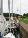 The three boat fleet in The St. Peters Canal. 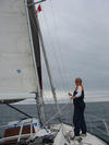 The only spinnaker visible on Chedabucto Bay. 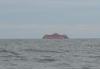 The Staten Island Ferry, again! 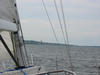 Infrared bearing down on Canso, NS. 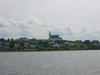 A nice view of the residential part of Canso, NS. |
||
| Thursday August 26, 2004 |
Halifax, NS |
The break from the southwesterly monsoon held for a very nice three day sail down the Eastern Shore of Nova Scotia from Halifax. Infrared was the only boat to visit the Canso marina on Sunday night so we had the place to ourselves. We had thought that Starling, one of the sailboats we befriended in St. Peters might also arrive, but it turns out they went on to Yankee Cove. Monday, we left early, rounding the breakwater outside the Canso marina at 0700 and made the ~60 nm trip to the Liscomb Lodge. It was a sunny and warm day, but with insufficient wind to sail, but it was easy motoring since the southwesterlies were nowhere to be found. Fortunately, I had called ahead to reserve wharf space at the lodge because, when we arrived, there was another boat already tied up and there is only space for two. That other boat was Ocean Wanderer, whom we had met in PEI and again in Pictou and then sailed with from Pictou to Ballantynes Cove. So it was great, the four of us had a good dinner at the lodge and planned the rest of the trip into Halifax. After making our way out of Liscomb Bay and into the ocean and expecting to find the predicted northwest wind, we were surprised to find a southwest wind! It must have been a local effect however, since there was no fog, and the sea state was never a problem. Additionally, the wind was just enough from our course direction that we could sail on a close reach with periods of motoring when we had to maneuver through the islands. This stretch has some of the nicest sailing through islands and shoals and the weather was sunny and relatively warm (it's never really hot on the water here) so it was a very good day. The two boats, Infrared and Ocean Wanderer, arrived at Sallys Cove (also called Shelter Cove) in Popes Harbor at about 1700 and put down the anchor. There were three other sailboats already in the cove, but there is plenty of space and it certainly didn't feel crowded. I inflated the dingy and we motored over to Ocean Wanderer where Diane had made a great spagetti dinner and Erwin had uncorked several bottles of wine. This was what sailboat cruising is all about. The anchorage was beautiful, the company very pleasing, and the sailing and weather had been very good. Wednesday has to rank as one of the best sailing days possible. We left Popes Harbor and had the perfect sailing conditions all the way into Halifax. Bright sunshine, blue skies, and a northwest wind that varied from 8-24 kt made for full sails and, since the wind was blowing offshore, a well behaved sea. Ocean Wanderer did pull away from us as the day progressed since its hard for a 35 ft boat to match speed with a 43 footer and when the wind was blowing over 15 kt, their weight was an advantage. However, we were both headed for the Royal Nova Scotia Yacht Squadron and we have ended up on the same pier, four slips apart. Erwin and Diane are long time members so we have met several of the other members and had a very sociable time eating in the clubhouse last evening. Today is another bright sunny day, a sign I hope, that perhaps the southwestern monsoon is on the brink of being displaced by the early autumn regime of more frequent west to northwest winds. Sandy is to fly out tomorrow and I will be in this area until, at least, the start of the Labor Day weekend. Jay is scheduled to arrive on Friday, September 3 and we will leave as soon thereafter as weather allows. Meanwhile, I will laze about Halifax and maybe do some daysailing or short overnights to Mahone Bay. |
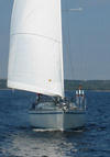 Ocean Wanderer leaving Liscomb. 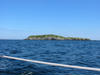 Passing Tuffin Island. 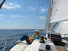 Sailing the inshore route. 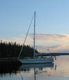 Dawn in Sallys Cove. 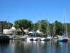 The Royal Nova Scotia Yacht Squadron. |
||
| Monday August 30, 2004 |
Halifax, NS |
Sandy did fly home on Friday and reports that, as of Sunday, Marmalade, the cat, has forgiven her for being away. I am still here in Halifax spending the time cleaning and making some repairs in Infrared. After almost 5000 nm of ocean coastal sailing over the two voyages, I had the first system failure on the boat. The light in the head stopped working in PEI! I finally had enough time to look at it carefully and I think I have fixed it. Otherwise, it's a lazy lifestyle here at the yacht club. I have met a few of the members and went to dinner with four folks last night at one of the many Chinese reataurants in Halifax. Another fellow has insisted that I use one of his cars while I am here, so I even have wheels! |
Some miscellaneous views around Halifax.
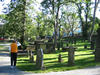 Checking out the old graveyard. 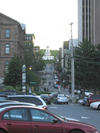 The Halifax Clock Tower. 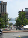 Throught the city, to the harbor. 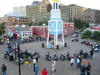 Bikes in Halifax. |
||
| Thursday September 2, 2004 |
Halifax, NS |
Nothing new to report. The weather has again turned sunny and autumn-like with pleasant west to northwesterly breezes. I am trying to get a handle on what Frances is going to do to our trek around Cape Sable and across the Gulf of Maine. Today's report suggests the storm will penetrate farther inland which is good, not only because that should mean its remnant will be farther west of us, but it will be over land longer and have more time to die. On the other hand, the MRF (one of the weather prediction computer models) places the remnant right over the Gulf of Maine on Wednesday and has it reinforced by jetstream energy. We will just have to watch and plan as we go along. With Jay arriving by air tomorrow night, the plan right now is to leave Halifax Saturday and sail to either Lunenberg or Liverpool, depending on winds. From there, it will be on to Lockeport which would be a sheltered spot to wait out nasty weather. From Lockeport, it's a day's travel to Yarmouth, also a reasonably safe spot to hide from trouble. |
|||
| Thursday September 9, 2004 |
Northeast Harbor, Maine |
The plan actually came together perfectly. Jay and I left Halifax last Saturday morning for Lunenburg. Then Sunday, it was off to Liverpool, followed by Lockeport on Monday. The long trip around Cape Sable went off without a problem on Tuesday, and we left Yarmouth very early Wednesday for the fifteen hour, 90-some nm passage across the Gulf of Maine to get here in Northeast Harbor. The reason for the rush we are seeing today. The remnant of Frances is passing with her heavy rain and near gale force winds so we are very happy to not be on the water!
There are a lot of details that I will fill in later when I have more time, but that's the Readers Digest condensed version. We plan to stay here a day (maybe more if the weather is slow to improve) and then make our way up (as opposed to "down east") the coast of Maine to arrive in Portland on Monday. |
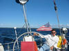 Perfect weather to sail the southwestern shore of Nova Scotia. 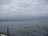 Not-so-perfect weather as Infrared arrives back in the USA. |
||
| Thursday September 9, 2004 |
Northeast Harbor, Maine |
The plan actually came together perfectly. Jay and I left Halifax last Saturday morning for Lunenburg. Then Sunday, it was off to Liverpool, followed by Lockeport on Monday. The long trip around Cape Sable went off without a problem on Tuesday, and we left Yarmouth very early Wednesday for the fifteen hour, 90-some nm passage across the Gulf of Maine to get here in Northeast Harbor. The reason for the rush we are seeing today. The remnant of Frances is passing with her heavy rain and near gale force winds so we are very happy to not be on the water!
There are a lot of details that I will fill in later when I have more time, but that's the Readers Digest condensed version. We plan to stay here a day (maybe more if the weather is slow to improve) and then make our way up (as opposed to "down east") the coast of Maine to arrive in Portland on Monday. |
Perfect weather to sail the southwestern shore of Nova Scotia. Not-so-perfect weather as Infrared arrives back in the USA. |
||
| Friday September 10, 2004 |
Northeast Harbor, Maine |
The front loaded with Frances' moisture is just now (near noon) trying to move away. It is possible that we will sail over to Stonington Harbor this afternoon if the winds go a little more northerly. Stonington is only ~20 nm away so we could make it in four hours and it would make the trip on Saturday into Rockland shorter. It depends on the weather. Yesterday, we took the shuttle bus into Bar Harbor and toured about in the rain. As sailors, we have the foul weather gear to handle wet weather so it wasn't bad at all. The town and the island are winding down from summer tourist mode into winter mode (i.e. closed), but at the moment everything is open so it's a good time to be here. |
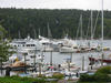 The well sheltered Northeast Harbor, ME.  Bar Harbor on a rainy day. 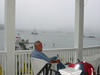 Rain? What rain? |
||
| Saturday September 11, 2004 |
Rockland, Maine |
We were indeed held over in Northeast harbor by the rain yesterday, but we made the best of it by going over to Southwest Harbor. We could have taken the boat which would have made it a trip of a few miles, but we decided to go overland, a trip of maybe 12 miles. The problem was that the buses decrease their number of trips and close down some routes after the first week in September, so either we had to go all the way into Bar Harbor and back again taking almost two hours each way or call a cab. As we were discussing the cab option another tourist with a car asked where we wanted to go and took us there for free. We walked around Southwest Harbor and saw the sights and, while waiting for the bus to take us back into Bar Harbor, I convinced Jay that we ought to get off the bus at the road to Northeast Harbor and we would hitchhike the eight or so miles back to the boat. We made a sign, got off the bus, and had a ride in fifteen minutes. That was Friday's adventure but we easily topped that today with a story of some amazing good luck and the Mahew brothers. The background information for this story has two parts: first that encounter Infrared had with the rocks in Andrew Passage two months ago in Nova Scotia, and second, the unbelievable number of lobster pots littering Maine waters. Here's the story. We happily departed Northeast Harbor for the easy trip to Rockland in light but sailable air and no sooner entered Blue Hill Bay than we snagged our first lobster trap. We swerved the boat around and managed to break it loose and continued on. In no time we snagged another and in swerving the boat managed to twist the spinnaker up so we had to drop it with that lobster pot still dragging. The only way to shake it loose from the keel was to start the engine and back up. That worked fine and the trap buoy floated free, however, in the confusion of the quick sail dowse a line (one of the spinnaker sheets) had gone overboard and, in an instant, had wrapped itself around the porpellor shaft stopping the engine. We worked with it for a while and got nowhere so I pulled out the dive gear we had on board. Jay volunteered to go down and cut us free. The problem was the unbelievably cold water temperature (58°F) and he could only stay in for five minutes. So I took a turn but fared even worse - it was so cold it took my breath away every time a put my head under. So here we were with no engine in the middle of Blue Hill Bay. Now we are a sailboat so we could still move somewhere, but the question was, to where? We were going to need a diver with proper equipment and it was Saturday. I got on the phone and started calling asking about divers and, after several calls, the dockmaster in Southwest Harbor suggested the Mahew boys who were local salvage divers. I called them and, in the amazing stroke of luck, they were on the water about to pass our position within a half hour! We couldn't believe it. They arrived on the scene with Brent already suited up and he cleared the line in short order. And they only charged $100. It seems that the dink in the keel from the Nova Scotia rocks was now making the keel into a hook, perfect for snagging lobster traps. It was of no consequence until we entered the ridiculous situation in Maine where there is a lobster trap every six feet. So we had to do something about the keel or it was going to be a long treacherous trip out of these waters. At the end of the day, however, we did make it to Rockland so in all the hubbub we hadn't lost any travel time. |
 The cheap way to get around Mt. Desert.  Into Rockland, ME. |
||
| Sunday September 12, 2004 |
Rockland, Maine |
When we arrived in Rockland yesterday and I saw a travel lift at the marina where we were staying, I had a faint hope that maybe I could bribe an operator into coming in, lifting Infrared into the sling and leaving her there overnight so we could repair the keel. Our lucky streak continued in full force when the first person I encountered at the yard this morning turned out to be the owner. When I told him my proposal, he said that would be fine, but it would be better if he just pulled the boat immediately, we did the repair, and he would drop us back in the water and we could be on our way. And, furthermore, he could provide the tools and materials for the work. What were the chances of getting this kind of service on a Sunday morning in a boatyard not open for business?! Infrared was up in the sling by 0830 and we started in. Jay's talent for drywall work paid off with a masterful job of applying and smoothing the fairing compound. There was a bit of drying time to wait out, but we were ready to go back in the water at 1230. The yard even had some spare bottom paint to cover the patchwork. |
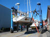 Infrared in a sling on a Sunday morning in Rockland, ME. 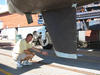 Jay's repair of the keel. |
||
| Tuesday September 14, 2004 |
Portland, Maine |
Sunday out of Rockland we were able to make it to New Harbor, ME, a real lobster port with no facilities at all for recreational boats. We pulled up to the wharf of a seafood restaurant and, after they told us we couldn't stay there, we met a fisherman who pointed us to his brother's wharf and said we could tie up there since the trawler was not due back for several more days. It was a fixed pier wharf and we left enough slack in our dock lines for a 6 foot tidal range. It turned out to be 8 feet and at 0330 we had to cut the dock line to keep from being lifted out of the water. At this point, we were thinking that the adventure never stops!
Monday was an excellent sailing day and we rocketed into Portland under sail all the way to the marina. Jay hopped a plane today so I am back to single handing. Although the winds don't look very favorable I expect to leave tomorrow for Isle of Shoals or Portsmouth, NH, and then on the Marblehead on Thursday. |
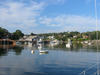 New Harbor, ME. |
||
| Friday September 17, 2004 |
Marblehead, MA |
It was a two day passage from Portland to Marblehead that began on Wednesday. After Jay left on Tuesday, I was on my own and when the marine weather forecast suggested that there would be southwest winds for the next four days, I decided that I couldn't wait it out. The forecast for Wednesday was for south wind 5-10 kt, a situation that I could handle. Either on a close reach or motoring through a behaved sea. Things went well enough early on but, as is the way of nature, it was downhill thereafter. A little more than halfway to Isle of Shoals, the wind picked up to SW 15-22 kt and (of course) directly on the nose. It was a wet bouncy slog the rest of the way. Gosport Harbor, in the Isle of Shoals was a welcome sight. I pulled up a mooring in a well sheltered spot and poured a few beverages. I knew I would be sailing to windward, but had hoped to avoid the pounding. Oh, well....
Early Thursday morning the wind was light from the south which was the course to Cape Ann so I got on the road quickly hoping to get to the cape and turn more westerly before the wind picked up. That worked out just fine. At the time I rounded the twin lighthouses on Cape Ann, the south wind became a beam reach and picked up to 10 kt and I could sail at 6.5 kt. Eventually, the wind died down so I motored the final few miles into Marblehead Harbor. Expecting it to be a simple process of picking up a mooring at the Boston Yacht Club, I was annoyed to find that they claimed to have no space. Calls to the other two yacht clubs were met with the ridiculous demand that transients are required to remain onboard while on a guest mooring! I was able to negotiate a dockside tie up with the Marblehead Harbormaster, a more expensive alternative to a mooring. I am staying at my sister's house and sleeping in a real bed and visiting with my parents through the weekend. Monday, I expect to leave for Provincetown on the tip of Cape Cod. From there, it will be a two day passage to Newport. The weather service is being vague about Jeanne's path, but it looks to me that, if it makes it up here, Thursday will be the day, so I want to be well secured in Newport by then. |
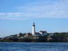 Lighthouse at the entrance to Porland, ME, harbor. |
||
| Thursday September 23, 2004 |
Newport, RI |
I arrived here in Newport yesterday after a three day passage out of Marblehead. Monday, I had an uneventful trip to Provincetown, having spotted no whales (although I did see a spout) or any other sea life. The only notable event was finding that the only facility in Provincetown with dock side accommodations had closed for the season! I asked the harbormaster about this and he indicated that the owner was having a temper tantrum because the city was not cooperating with some scheme he had. Things worked out reasonably well, however, when I asked some folks on another dock if there was space and the owner allowed me to tie up on one of the ferry docks for the night at no charge. Tuesday, I left Provincetown for Buzzards Bay and, since the current in the Cape Cod Canal didn't turn south until 1500, it was a leisurely trip under sail at 5 kt across Cape Cod to the canal. When the almanac says the current changes, it really does change! I entered the canal a little early and found an adverse current of about a knot, the current went slack shortly afterward, and within 20 minutes I had a 2.5 knot southbound currrent pushing me along at 9 kt. Since it was getting late, I grabbed a mooring in Mattapoisette Harbor but the wind, which had been northerly all day, went southeasterly and blew in the harbor entrance most of the night, rocking the boat and making sleep difficult. Oh, well, it was up early and off to Newport in light air but I did get some good sailing in over the last ten miles or so. I am at the Newport Yachting Center and will leave tomorrow for the trip down Long Island Sound. It's hard to say how far I will get, it will be either a two or three day trip to City Island from which I will time the East River passage and the trip down the New Jersey coast - the least attractive part of the whole journey. |
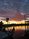 Sunset in Provincetown. 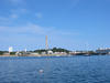 Leaving Provincetown.  Sunset in Mattapoisette Harbor. |
||
| Tuesday September 28, 2004 |
City Island, NYC |
In the most unbelievable development of this entire trip, I have found out that the US Coast Guard has closed the East River west of Roosevelt Island to recreational vessels! This creates a very dangerous situation where it's necessary to have the draw bridge on the east side raised while one is running with a 5-6 kt current. Sailboats like Infrared can only be pushed by motor at 6-6.5 kt so if the bridge isn't up, it's almost impossible to stop forward motion. What are these fools thinking about??!! Otherwise today, I am waiting out weather being produced by the remnant of Jeanne and a combination of fronts. The expectation is for very heavy rain today and tonight wind winds 20 - 30 kt to follow. I would like to transit the East River past Hell Gate tomorrow and either tie up at a marina in New York Harbor or maybe proceed to Sandy Hook. It will depend on how windy it actually is. If it's too windy I'll stay here until Thursday. I hope to be in Manesquan Inlet Thursday night. Last Friday, I had planned to leave Newport but when I was releasing the dock lines at 0630, I noticed that the engine wasn't pumping seawater at the full rate. This is critical for cooling the engine so it had to be fixed. First, I checked the trap for sea grass and other things but found it virtually clear, then I checked the impellor which had some tears in the vanes so it needed to be replaced. As is the way with things sometimes, the spare impellors did not match the one removed from the pump. Being in Newport, it was a short distance to a Yanmar parts desk, but it didn't open until 0800. When I got the part, I was told that the new engine was manufactured in Europe and it uses a different pump than the Yanmars manufactured elsewhere! OK, so I fixed that but it didn't solve the water flow problem. Next, I pulled the hose to see if it was clogged, but found instead that the sea cock was not admitting a full flow. I pushed a flexible vinyl strip through it but couldn't improve the flow. Water was coming through, but not enough. The next thought was that there was something underneath the boat obstructing the flow (a plastic bag, a wad of sea weed, or whatever). I put on the dive suit, dove under the boat but could find nothing. Now it was a real mystery. A sea cock isn't that complicated or that big, but somehow it was partially clogged with something not visible from either side! The only solution I could come up with was to swap the engine water intake line with the other seawater intake that provides water to the galley and to flush the head. The two sea cocks are close together but I needed to go find additional hose, connectors, and clamps to do the switch. After several hours, I had made the switch and the engine was pumping just fine. By then, however, it was early afternoon and too late to get out of Newport. So it was very early Saturday morning that I left heading into Long Island Sound. The expected southwest wind actually was more westerly so it was more effectively "on the nose" so it was a long day of motoring to windward. I covered 52 nm and arrived at the Connecticut River and tied up at Harbor One Marina because it was closest to the Sound. This marina is power boat heaven! Infrared was the only sailboat among some 200 power boats. Oh well, it was just and overnight stop and the facilities were first class. Sunday, was another long day (57 nm) that took me to Huntington Harbor and a mooring at the Huntington Yacht Club. It was a very nice day although the wind was too light and astern for sailing my course. There was a huge amount of boat traffic all around Huntington. Every goomba and his consiglieri was racing about in his power boat and there were plenty of sailboats out, too. Although they didn't have dockspace, the yacht club was very accommodating and gave me a dingy to use after the launch service to the moorings ended for the day. At this point, I was close enough to New York that on Monday I needed to find a reasonably sheltered spot to await the passing of Jeanne. After several calls to various marinas and getting pretty much the same horrible or befuddled service so common in the marine industry, I ended up here at City Island in the South Minneford Yacht Club where they are quite helpful. However, this is not the most sheltered spot so it might be a bumpy night when the winds pick up. |
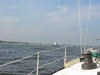 Arriving at Old Saybrook, CT. 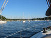 Huntington Harbor. 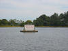 Leaving Huntington Harbor. |
||
| Saturday October 2, 2004 |
Cape May, NJ |
The Office of Homeland Security did not succeed in sinking Infrared, although the Coast Guard people I spoke with would have shrugged it off, I'm sure, as a reasonable price for our protection of the UN complex. I called the bridge tender in the morning to hear from him what to expect and he was quite helpful. He said I was the only one to have called that morning, so I was somewhat surprized to find myself leading a pack of seven other sailboats into Hell Gate. When I hailed the bridge tender on the radio, he again said he had heard from only me and I should come ahead. I, of course, told him that I had these other poor pilgrims in tow so we all made it through without incident. That night, I fueled up and anchored over behind the breakwater in Atlantic Highlands near Sandy Hook. By this point, I was surrounded by other cruising sailboats all heading south. This, after seeing virtually no other sailboats cruising in my direction up until the Throgs Neck Bridge. A dawn departure from Sandy Hook still didn't get me to Atlantic City before dark, but with the chart plotter and having been there before it was not an impossible task. A big current (much bigger than I remember ever seeing) in the inlet made taking down the mainsail in the dark a fun job. Once the anchor was set, I ended up leaving the plotter on all night so I could check whether the boat had dragged the anchor as the current reversed (it didn't). The next morning (this morning) I was again up and pulling up anchor at dawn. Or, at least trying to pull up the anchor. The strong current had buried the Fortress anchor deep in the mud, which is good for holding the boat, but is bad when trying to free it in the morning. The main winch and some motorized coaxing finally worked and off I went into what was forecast to be a south wind at 5 - 10 kt. The south part was right, but the speeds were more like 12 - 22 kt. It was a close reach into lumpy 3-5 foot seas with some rain arriving for good measure. I made Cape May at 0130 soaking wet, beat up and tired, and never happier to see the place. The forecast had the wind picking up this afternoon in advance of a cold front expected to arrive overnight. If the typical strong northerly winds follow the front are here tomorrow, I am staying. There is no way I will purposely pound my way up the Delaware Bay! |
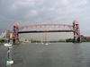 My parade past the drawbridge.  NYC in the rear view mirror.  Atlantic City in the dark. 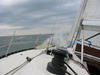 It was a wet sail from Atlantic City to Cape May. |
||
| Sunday October 3, 2004 |
Cape May, NJ | The wind today on the Delaware Bay is forecast to be north "around" 15 kt. Since 20 is "around" 15, and 20 kt on the nose against the current is not a happy sailing situation, I am staying put in Cape May and will depart tomorrow morning. | |||
| Wednesday October 6, 2004 |
Baltimore, MD | I am back! Infrared made a very fast passage from Chesapeake City on The C & D Canal to Baltimore yesterday arriving at 2130. It was a very good idea to wait until Monday to go from Cape May up the Delaware Bay. The north wind was up to 20 kt during the late morning to early afternoon and actually forced a few trawlers to return to Cape May. Monday was almost perfect for a passage. While the breeze was too light for true sailing, it provided a nice lift for motor sailing and, with the current running in my favor, it was a painless run to Chesapeake City. On previous trips, I had always tied up at Schaeffer's Canal House on the C & D Canal, but this time, since I was alone, making the tie up very difficult in the current, and the fact that the Sunkler family no longer owns the facility, thereby removing the social element, I decided to try the anchorage lagoon on the south side of the canal. The charts note a 5˝ ft depth in the entrance, but Reed's Almanac reported that it was dredged to 10 ft. I slowly felt my way in and passed over the bar into 10-15 feet of water in the lagoon itself. Anchoring, however, turned out to be quite a problem. After trying a few different spots, I was eventually able to get the anchor to grab and settled in for cocktails and dinner on board. Shortly before 0100, I checked the plotter and it suggested that Infrared might be moving. By the time I pulled on my shorts and shoes, Infrared had dragged the anchor enough to bump a neighboring sailboat. The couple on board were, of course, up in a flash and were very helpful in fending off and very gracious about the bump in the night. At this point, I went over to U.S Army Corps of Engineers steel workboat that was tied up to their wharf and rafted up. I was planning to leave at first light which was about 3 hours after high tide so I figured that, even if the army complained, I would be leaving anyway. I dropped the lines from the steel boat in twilight at 0615 and slowly began to move out to the canal. I didn't get there. The water depth by then had dropped to less than six feet on the bar and I couldn't get out. The Corp of Engineers crew for the other boat had by now arrived so I asked their advice about where the water might be deep enough but I still couldn't get out. So then I asked if it was alright to tie up again to the other steel boat and wait for the higher afternoon tide, which they said would be okay. I have to say that I am grateful to the Corps of Engineers folks on the C & D Canal for being very hospitable and helpful to me. Since I had to wait nine hours, it was a great benefit to be tied up to the steel boat rather than at anchor since I could get off Infrared and kill time in town. As I was returning to the boat about 1400, another sailboat was pulling up anchor and as they were exiting, I asked their draft (6' 7"!!) and the skipper called out his depth readings as he went across the bar. He made it with maybe 3" to spare so I immediately made ready to leave myself. It was a huge benefit to get out at 1430 rather than waiting until full high tide at 1600. I was able to take maxium advantage of the favorable current that carried me all the way to North Point at an average speed of slightly over 7 kt. Furthermore, I was able to get past Poole's Island before dark, so by then I was away from the upper bay shipping channel and the confusion of lights and beacons thereabouts. It was a welcome sight to round Ft. McHenry and drop the sails and tie up at Canton Cove...home. |
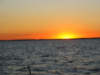 The last leg home. |
||
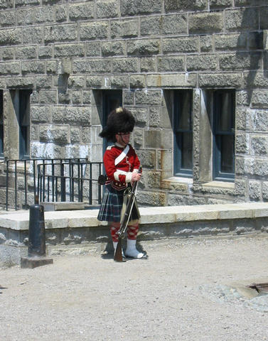
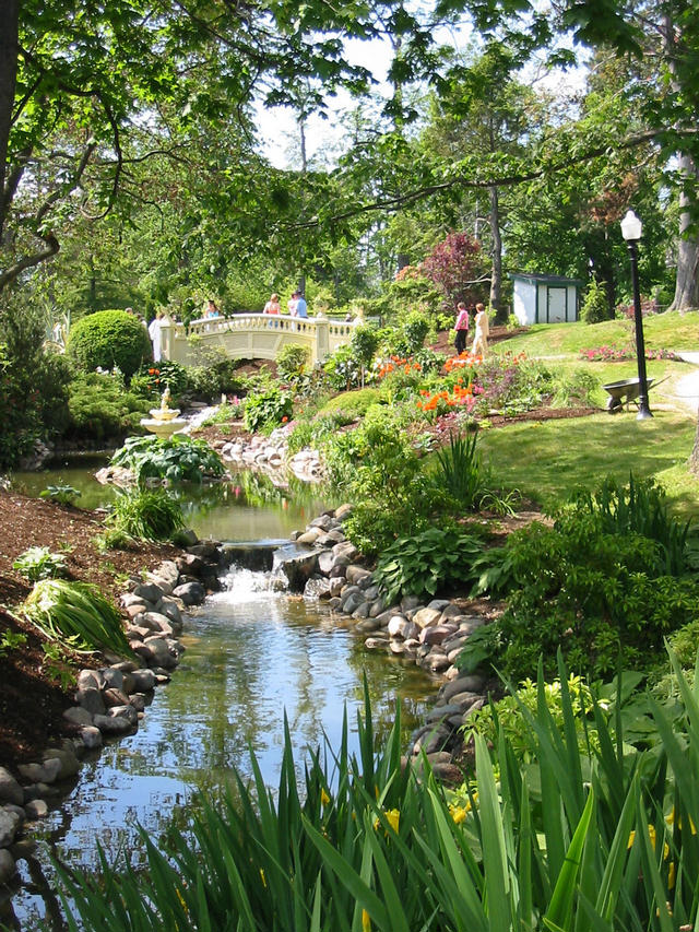


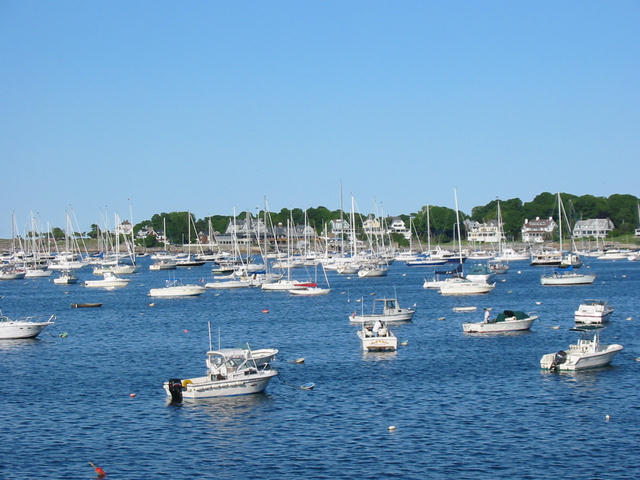
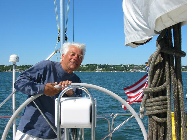